Business Details
40 Years
experience
Expert Hydrographic Surveyors in Alaska
Established in 1986, Hughes & Associates is a veteran-owned surveying firm based in Wasilla, Alaska, with over 30 years of expertise in hydrographic and land surveying. Our team specializes in delivering high-precision data using cutting-edge technology, including multi-beam swath bathymetry and GNSS real-time positioning systems. We serve diverse projects across Alaska, from dredging support in coastal harbors to marine construction and geotechnical surveys. Our commitment to integrity, quality, and safety ensures clients receive accurate, cost-effective deliverables tailored to their needs. With decades of experience in Alaska's challenging environments, we combine technical proficiency with rapid response capabilities to meet tight deadlines. Our core values drive every project, ensuring superior results for federal agencies, private clients, and international partners.We maintain long-standing relationships through transparent communication and innovative solutions, including ship-born laser scanning. As a small business, we prioritize personalized service while competing with larger firms through efficiency and competitive pricing. Our work spans Southeast Alaska, the Aleutian Islands, and beyond, supporting infrastructure development and environmental stewardship. We pride ourselves on adapting to evolving industry standards, transitioning from single-beam to advanced multi-beam survey equipment. Clients trust us for precise data collection, volume computations, and plan-view drawings that meet rigorous engineering requirements.
Services
Hydrographic Surveys
Multi-Beam Bathymetry
Dredging Support
Marine Construction Surveys
Geotechnical Data Collection
Laser Scanning
Condition Surveys
Topographic Mapping
Volume Computations
Federal Project Compliance
Details
- Year established: 1986
Highlights and features
- We offer over 30 years of experience in hydrographic surveying since 1986.
- Our veteran-owned team utilizes cutting-edge multi-beam and laser scanning technology.
- We provide cost-effective solutions with rapid response capabilities in remote areas.
- Our focus on safety and quality ensures accurate, federally compliant deliverables.
- We maintain long-standing partnerships through transparent communication and innovation.
Services
Hydrographic Surveys
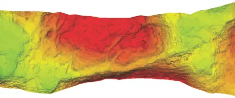
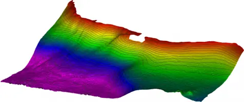
We conduct comprehensive hydrographic surveys using advanced multi-beam sonar and GNSS systems to map underwater terrain. Our services support dredging, construction, and environmental monitoring in Alaska's coastal regions. Clients receive detailed bathymetric charts and volume calculations for informed decision-making.
Dredging Support
Our pre- and post-dredging surveys ensure compliance with federal standards through precise sediment volume measurements. We serve ports in Dillingham, Homer, and Nome, providing data for navigation safety and infrastructure planning in challenging Arctic conditions.
Marine Construction Surveys
We support breakwater expansions, revetments, and new harbor projects with real-time positioning and 3D modeling. Our surveys ensure structural integrity for marine infrastructure across Alaska's dynamic coastal environments.
Laser Scanning
Ship-mounted and vehicle-based laser scanning captures high-resolution topographic data for coastal erosion studies and infrastructure assessments. This technology enhances accuracy in mapping complex shorelines and submerged structures.
Geotechnical Surveys
We collect and analyze seabed data for engineering projects, partnering with labs to assess soil stability and environmental impacts. Our work supports offshore construction and resource development in Alaska's rugged terrain.
Questions
What geographic areas do Hughes & Associates serve?
We operate throughout Alaska, including Southeast Alaska, the Aleutian Islands, and coastal communities like Dillingham, Homer, and Nome.
What technologies does Hughes & Associates use?
We utilize multi-beam sonar, GNSS positioning, and laser scanning for precise hydrographic and topographic data collection.
How long has Hughes & Associates been in business?
We've provided surveying services since 1986, with over 30 years of experience in Alaska's marine environments.
What industries benefit from your services?
Our clients include federal agencies, port authorities, and construction firms requiring dredging support, marine infrastructure surveys, and geotechnical data.
How do you ensure data accuracy?
We combine advanced technology with rigorous quality control processes to deliver federally compliant, publication-ready survey results.
Can you handle remote or challenging projects?
Yes, our team specializes in Alaska's harsh conditions, offering rapid deployment and solutions for complex coastal and Arctic environments.