
Business Details
Expert Ground Penetrating Radar Services in Oahu, HI
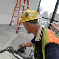
Haggiths Structural Scan & Inspection has established itself as a leader in non-invasive subsurface imaging solutions for construction and engineering projects. Our team specializes in deploying advanced ground penetrating radar (GPR) and high-imaging electromagnetic systems to identify buried obstructions, utilities, and structural elements with precision. Operating across all Hawaiian islands, we serve commercial and industrial clients who require accurate data before cutting, coring, or excavating.Our technicians combine decades of field experience with pre-9/11 technology that delivers superior scanning power compared to modern equipment. We prioritize safety, efficiency, and reliability, offering services that reduce project risks, prevent costly errors, and ensure compliance with industry standards. Our commitment to quality extends to comprehensive QA/QC reporting and real-time on-site support that keeps projects moving forward without unnecessary delays.
Services
Concrete Scanning
Utility Locating
Ground Penetrating Radar
EM Systems Mapping
Subsurface Imaging
Highlights and features
- We use pre-9/11 technology with stronger scanning capabilities than modern equipment
- Our team provides on-site rebar, conduit, and cable detection services
- We offer comprehensive QA/QC reporting for engineering compliance
- Our non-invasive methods prevent job-site disruptions and radiation exposure
- We serve all Hawaiian islands with rapid response capabilities
Services
Concrete Scanning
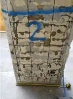
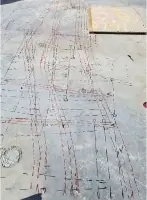
Our concrete scanning service uses high-resolution ground penetrating radar to map rebar, tension cables, conduits, and voids within concrete structures. This non-destructive method allows safe cutting and coring operations by identifying embedded obstructions up to 18 inches deep. Clients receive detailed color-coded reports that guide construction decisions while maintaining structural integrity.
Utility Locating
Utility locating identifies buried utilities including electrical lines, gas pipes, water mains, and communication cables using electromagnetic systems. Our technicians create accurate subsurface maps that prevent accidental damage during excavation. This service supports safe trenching operations and compliance with municipal regulations across commercial and industrial sites.
Ground Penetrating Radar
Ground penetrating radar provides high-resolution imaging of subsurface features in concrete and soil. Our pre-9/11 technology delivers stronger signal penetration than modern systems, revealing hidden voids, utility pathways, and structural anomalies. This data supports engineering analysis for bridge decks, pavements, and building foundations across Hawaii.
EM Systems Mapping
EM systems mapping detects metallic objects and utilities through electromagnetic field analysis. This complementary technology works alongside GPR to trace pipes and cables in challenging environments. Our color-coded identification system improves clarity for construction teams needing precise subsurface awareness before excavation or structural modifications.
Subsurface Imaging
Subsurface imaging combines multiple technologies for comprehensive geophysical investigations. Our services include pavement analysis, bridge deck evaluation, and slab thickness measurements using non-destructive methods. Clients receive actionable data that informs maintenance planning, structural assessments, and construction safety protocols across diverse infrastructure projects.
People
Haggith
Founder
With decades of experience in structural engineering and geophysical investigations, Haggith established the company to provide advanced subsurface imaging solutions. His technical expertise in pre-9/11 GPR technology ensures clients receive superior data quality for complex construction projects across Hawaii.
Questions
What is ground penetrating radar (GPR)?
Ground penetrating radar uses radio waves to create subsurface images of objects embedded in concrete or soil. Our pre-9/11 technology provides stronger signal penetration for deeper, more accurate imaging than modern systems.
Which areas do you service?
We operate across all Hawaiian islands including Oahu, Maui, Big Island, and Kauai. Our mobile equipment allows rapid deployment to construction sites statewide.
How deep can your scans reach?
Our concrete scanning reaches 18 inches in structural elements. For deeper subsurface investigations in soil or pavement, our utility scan systems can detect objects at greater depths using complementary technologies.
What safety advantages do you offer?
Our non-invasive methods eliminate radiation exposure and prevent job-site disruptions. The technology works safely in occupied buildings and public areas without requiring destructive testing.
What information will I receive after scanning?
Clients receive detailed color-coded reports showing detected objects' locations, depths, and dimensions. We also provide QA/QC documentation for engineering compliance and construction planning purposes.
Videos