Business Details
20 Years
experience
Expert Construction Contractors in Honolulu, HI
Hawaii Geophysical Services has been a technological leader in ground-penetrating radar (GPR) systems for 17 years, founded by Lelan Hein, a licensed contractor with 35 years of construction expertise. Our team, led by Civil Engineer Canaan Shon, specializes in subsurface engineering, utility locating, and concrete scanning using cutting-edge technologies. We serve construction, environmental, and government clients across Hawaii and the Pacific Rim, delivering accurate data for projects at locations like Schofield Barracks and Pearl Harbor Naval Base. Our commitment to innovation began with solving plumbing and leak detection challenges, evolving into a comprehensive suite of services including vacuum excavation, subsurface mapping, and RFID utility tracking. With over a decade of field experience, our technicians combine academic training and practical expertise to provide non-destructive solutions that enhance project safety and efficiency.We prioritize client collaboration, offering personalized support to address unique subsurface challenges while maintaining strict adherence to quality standards. Our work has demonstrated cost savings of up to 50% compared to traditional methods, supported by partnerships with organizations like the University of Hawaii and U.S. military installations. From sand filter replacements to complex utility mapping, we ensure precise results that minimize risks and optimize outcomes. Our legacy of technical excellence continues through advanced equipment investments and a focus on real-time data visualization for client transparency. By integrating GPS Total Station technology and adhering to industry best practices, we deliver actionable insights that empower informed decision-making for infrastructure development.
Services
Ground Penetrating Radar
Utility Locating
Concrete Scanning
Subsurface Mapping
Sand Changeouts
Vacuum Extraction
Potholing
Electromagnetic Utility Locating
Utilities Mapping
Keyholing
Details
- Year established: 2006
Highlights and features
- 17 years of specialized expertise in ground-penetrating radar and subsurface engineering
- Civil engineer-led team with over a decade of field experience
- Proven cost savings of 30-50% compared to traditional methods
- Non-destructive testing solutions for concrete and underground utilities
- Extensive project history with military, government, and commercial clients
Services
Ground Penetrating Radar
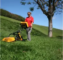
Our ground-penetrating radar systems use microwave band electromagnetic radiation to create detailed subsurface images. This non-destructive technology detects buried objects, voids, and material changes in soil, rock, and concrete structures. Clients benefit from real-time data visualization that improves project safety and reduces excavation risks for construction and environmental applications.
Utility Locating
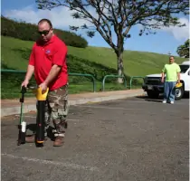
We employ electromagnetic and radiolocation technologies to identify metallic and non-metallic underground utilities. This service prevents accidental damage during excavation by accurately mapping water, gas, electrical, and telecommunications infrastructure for construction and maintenance projects across diverse industries.
Concrete Scanning
Our concrete scanning technology detects rebar, tendons, and voids in structural elements using surface-penetrating radar. This non-invasive method provides 2D/3D visualization with millimeter accuracy, enabling safe drilling and cutting operations while maintaining structural integrity in commercial and residential buildings.
Vacuum Extraction
We use pressurized air and vacuum systems for safe excavation near sensitive underground utilities. This dual-method approach minimizes damage risks while efficiently removing soil for utility exposure, potholing, and trenching applications in congested or high-risk environments.
Subsurface Mapping
Our subsurface mapping service combines GPR and electromagnetic data with survey benchmarks to create comprehensive underground utility records. This process supports cost-effective design decisions by providing accurate as-built information that reduces project delays and prevents utility conflicts during construction.
People
Lelan Hein
Past President
Founder of Hawaii Geophysical Services with 35 years of construction experience, Lee Hein pioneered innovative subsurface solutions. His plumbing contractor background led to developing advanced leak detection methods, establishing the company's technical foundation before passing away in 2021.
Canaan Shon
General Manager
Civil Engineer Canaan Shon leads operations with over a decade of subsurface technology expertise. He manages projects at military installations and critical infrastructure sites, applying academic training from the University of Hawaii to enhance service delivery and technical innovation across the Pacific Rim.
Lawrence Young
Senior Technician
Senior Technician Lawrence Young specializes in electromagnetic utility locating and subsurface mapping. With extensive field experience, he operates advanced detection equipment to support complex infrastructure projects requiring precise underground utility identification and documentation.
Robin Silva
Vac Truck Operator
Vac Truck Operator Robin Silva executes precision excavation projects using vacuum extraction technology. He ensures safe utility exposure through coordinated air lance operations, maintaining compliance with industry safety standards during potholing and subsurface maintenance activities.
Halida Tuerxun
Office Manager
Office Manager Halida Tuerxun oversees administrative operations with 16 years of government project support experience. Her background in financial reporting and proposal management ensures efficient business operations while maintaining compliance with contractual requirements for public sector clients.
Questions
What subsurface detection technologies do you use?
We use ground-penetrating radar, electromagnetic locating, and vacuum extraction technologies to detect underground utilities, structural elements, and geological features with millimeter-level accuracy.
How do you ensure utility mapping accuracy?
Our technicians combine GPS Total Station benchmarks with real-time radar imaging to verify subsurface features against existing plans, achieving 20mm precision in utility location data.
Can you work on active military installations?
Yes, we have extensive experience at military bases including Schofield Barracks and Pearl Harbor, maintaining security clearances and following strict protocols for facility upgrades and infrastructure projects.
What concrete scanning benefits do you provide?
Our non-destructive concrete scanning prevents structural damage by locating post-tension cables and rebar, reducing risks during drilling operations while maintaining building code compliance.
How do you handle emergency utility repairs?
We prioritize urgent requests through dedicated scheduling, using rapid deployment equipment for leak detection and subsurface assessment to minimize service disruptions during critical infrastructure failures.
What industries do you serve?
We support construction, environmental, government, and military sectors with subsurface solutions, including utility mapping for telecommunications, water infrastructure, and commercial development projects.