
Business Details
22 Years
experience
Professional Surveying Services in Lincoln, NE
Husker Surveying has served Lincoln and surrounding communities since 2004, delivering precise surveying solutions for projects of all sizes. Our team operates two field crews dedicated to completing surveys efficiently while maintaining rigorous accuracy standards. Owner Jayme Malone, a licensed surveyor since 1986, brings over 39 years of professional expertise to every project. We maintain active licenses across five statesNebraska, Kansas, Missouri, Iowa, and Wisconsinto better serve regional clients. Our services combine advanced technical capabilities with decades of practical experience in boundary determination and construction layout.We specialize in legal lot surveys, elevation certificates, and ALTA-compliant commercial surveys meeting title insurance requirements. Our construction staking services ensure proper building placement using modern geospatial technologies. We conduct topographic mapping for infrastructure planning and subdivision platting in compliance with local regulations. Our tower surveying division supports telecommunications clients with FAA-compliant antenna measurements. Every project benefits from our commitment to technical excellence and client-focused service delivery.
Services
Legal Lot Surveys
Boundary Determination
Construction Staking
Elevation Certificates
ALTA Surveys
Subdivision Plats
Tower Surveying
Topographic Mapping
Letter of Map Amendments
Section Splits
Details
- Year established: 2004
Highlights and features
- Owner-operated since 2004 with continuous service in Lincoln
- Licensed surveyor with 39+ years of professional experience
- Multi-state licensing across five Midwestern jurisdictions
- Specialized expertise in ALTA/NSPS commercial survey standards
- Comprehensive FAA-compliant tower survey capabilities
Services
Legal Lot Surveys
Our legal lot surveys precisely locate property pins using original plats and recorded surveys. We verify boundary lines to hundredths of a foot accuracy without improvement mapping. This service meets legal requirements for property transactions and boundary disputes.
Construction Staking
We provide accurate building placement services for foundations and improvements. Our staking ensures proper alignment with property boundaries and regulatory requirements. This service supports residential and commercial construction projects from initial layout through completion.
Elevation Certificates
Our elevation certificates measure property elevations against FEMA benchmarks. We prepare these for floodplain determination and insurance requirements. This service includes Letter of Map Amendment preparation to potentially remove flood insurance mandates.
ALTA Surveys
We conduct ALTA/NSPS standard surveys for commercial properties. Our comprehensive mapping includes improvements, utilities, easements, and zoning setbacks. This service meets title insurance requirements with detailed property documentation.
Tower Surveying
Our specialized tower surveys locate lease areas and measure antenna heights for FAA compliance. We provide precise latitude, longitude, and elevation data. This service supports telecommunications companies with site planning and regulatory submissions.
People
Jayme Malone
Owner & Licensed Surveyor
Registered Land Surveyor with 39+ years experience. Licensed in five Midwestern states. Specializes in boundary determination and construction surveying since 1986.
Questions
What survey types do you specialize in?
We specialize in legal lot surveys, ALTA/NSPS commercial surveys, construction staking, elevation certificates, and FAA-compliant tower surveys.
Are your surveyors licensed in multiple states?
Yes, our lead surveyor holds active licenses in Nebraska, Kansas, Missouri, Iowa, and Wisconsin.
How do you handle subdivision plats?
We prepare final plats meeting local regulations, including utility easements and public right-of-way requirements for property division.
Do you provide emergency survey services?
We maintain regular business hours but prioritize urgent requests based on project timelines and client needs.
What technology do you use for measurements?
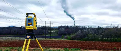
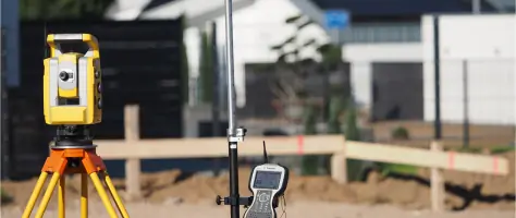
We employ modern geospatial equipment including total stations, GPS systems, and digital leveling instruments for precise data collection.
