Business Details
39 Years
experience
Your Trusted Surveying and Engineering Partner in Grand Rapids
Roosien & Associates has been delivering professional land surveying and engineering services to Grand Rapids and West Michigan since 1987. Our team of licensed professionals combines decades of experience with advanced technical expertise to serve residential and commercial clients. We specialize in ALTA/ACSM Land Title Surveys, elevation certifications, topographic mapping, and comprehensive site planning. Our civil engineering department handles projects ranging from backyard drainage solutions to complex commercial developments, ensuring precision and compliance with local regulations.With deep roots in the community, we maintain strong relationships with municipalities, architects, and developers to streamline land use projects. Our commitment to accuracy and client communication has earned us consistent recognition from realtors, lenders, and attorneys. We prioritize clear documentation and timely execution, whether completing FEMA elevation certificates or designing sustainable residential communities. Our staff regularly participates in FEMA-sponsored training to maintain technical proficiency in floodplain mapping and LOMA submissions.
Services
Land Surveying
Civil Engineering
Site Planning
ALTA Surveys
Elevation Certificates
Details
- Year established: 1987
Highlights and features
- We have 36 years of local experience serving West Michigan since 1987
- Our team includes licensed professional engineers and surveyors
- Specialized expertise in ALTA/ACSM Land Title Surveys for commercial transactions
- Certified professionals in FEMA elevation certificate preparation and LOMA submissions
- Direct collaboration with municipalities to streamline permitting processes
What people say
Top notch service
Nice people
Quick and responsive
Highly recommend
Great at what they do
Services
Land Surveying
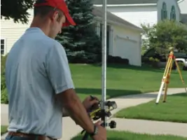
Our experienced surveyors execute precise boundary, mortgage, and construction surveys for residential and commercial properties. We utilize advanced equipment to ensure accurate measurements that meet legal requirements. Our team provides documentation that satisfies lender and municipal requirements while maintaining strict adherence to professional standards.
Civil Engineering
We offer comprehensive engineering solutions from small drainage projects to large-scale commercial developments. Our services include road design, utility planning, and stormwater management systems. Our engineers work closely with clients to create functional designs that comply with all regulatory requirements while optimizing property usability.
ALTA Surveys
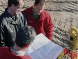
We specialize in ALTA/ACSM Land Title Surveys for commercial real estate transactions. Our surveys meet strict industry standards and include detailed property boundary analysis, easement identification, and improvement verification. These comprehensive surveys help clients understand property rights and potential development constraints.
Elevation Certificates
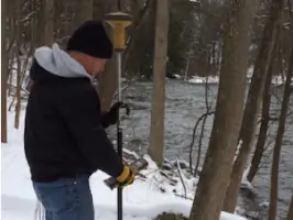
Our certified professionals complete FEMA elevation certificates to determine flood zone status and insurance requirements. We use precise measurements to verify property elevations against FEMA maps. When appropriate, we prepare Letter of Map Amendment (LOMA) applications to potentially remove properties from flood zones.
Site Planning
We create customized site plans that maximize property potential while considering environmental factors. Our planning includes road placement, drainage solutions, and utility coordination. We work with local authorities to secure necessary permits and ensure projects meet all zoning and development regulations.
People
Matthew Cole
Project Manager / Professional Engineer
Matthew Cole combines engineering expertise with project management skills to deliver precise solutions for complex development projects at Roosien & Associates.
Paul Henderson
Project Manager / Professional Engineer
Paul Henderson oversees engineering projects with attention to technical accuracy and regulatory compliance, ensuring client needs are met efficiently and effectively.
Adam Meyering
Professional Surveyor
Adam Meyering conducts detailed land surveys using advanced technology, maintaining high standards of precision and documentation for residential and commercial properties.
Mike Manning
Professional Surveyor
Mike Manning performs field surveys and boundary analysis with meticulous attention to detail, supporting accurate land development and property transactions.
Questions
What surveying services do you offer?
We provide boundary surveys, ALTA/ACSM Land Title Surveys, elevation certificates, topographic mapping, and construction staking for residential and commercial properties.
Do you serve areas outside Grand Rapids?
We primarily serve West Michigan, including Kent, Ottawa, Muskegon, and Allegan counties for most surveying and engineering projects.
What is an ALTA survey?
An ALTA survey is a detailed boundary survey meeting national standards that shows property boundaries, improvements, easements, and other features important for commercial real estate transactions.
How do elevation certificates help with flood insurance?
Our elevation certificates verify building elevations relative to FEMA flood maps, potentially reducing or eliminating flood insurance requirements through LOMA applications.
What are your office hours?
Our office is open Monday-Friday 8:00 AM to 5:00 PM. Field services are available by appointment Monday-Saturday.