
Business Details
13 Years
experience
Your Trusted Partner for Accurate Land Surveying in Louisville
Founded in 2013 by Jason Graves, a Professional Licensed Surveyor with over 20 years of experience, Century Land Surveying combines decades of industry expertise with cutting-edge technology to deliver precise and reliable land surveying solutions. Our team prioritizes client collaboration, utilizing GPS and data collection systems from industry leaders like Trimble and Leica to ensure unmatched accuracy. We specialize in boundary surveys, ALTA/ACSM title surveys, topographic mapping, and construction layout services, serving commercial and residential clients across Louisville, Kentucky, and surrounding counties.Our commitment to historical research, including access to over 200 years of Louisville survey records, ensures comprehensive insights for every project. Recognized for our client-centered approach, we provide direct access to professionals who understand project-specific challenges without bureaucratic layers. Century Land Surveying stands by its work with transparent communication, proven results, and a dedication to advancing Kentuckys surveying legacy.
Services
Boundary Surveys
Mortgage Inspections
Building Stakeout
Site Plans
ALTA Surveys
Topographic Mapping
Details
- Year established: 2013
Highlights and features
- We offer 20+ years of experience in professional land surveying.
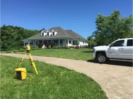
- Our team utilizes GPS and data systems from Trimble and Leica.
- We provide access to 200+ years of Louisville survey records.
- Our client-centered approach ensures direct collaboration with experts.
- Proven track record completing hundreds of projects annually.
Services
Boundary Surveys
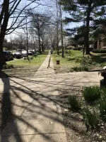
Boundary surveys establish precise property lines and corners based on historical records and field measurements. This service ensures legal clarity for land transfers, construction, or dispute resolution. Our surveys meet court-admissible standards while incorporating over 200 years of Louisville's historical survey data for enhanced accuracy.
ALTA Surveys
ALTA/ACSM title surveys meet the highest industry standards for commercial real estate transactions. These comprehensive surveys include boundary verification, easements, and improvements, adhering to lender requirements and minimizing legal risks. Our team ensures compliance with Table A specifications for seamless property transfers.
Topographic Mapping
Topographic mapping documents terrain features and elevations for development or floodplain analysis. This service supports construction planning, drainage studies, and environmental assessments. We integrate GPS technology with historical data to create detailed, actionable maps for residential and commercial projects.
Construction Layout
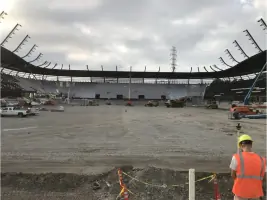
Construction layout services ensure accurate placement of buildings, roads, and utilities based on architectural plans. Our team stakes critical points for foundations, utilities, and infrastructure, maintaining precision throughout the development process. This service supports efficient permitting and construction in Louisville and surrounding areas.
Mortgage Inspections
Mortgage inspections verify property boundaries and improvements for title insurance purposes. While not suitable for construction, these surveys identify encroachments or discrepancies that could affect property transactions. Our inspections meet lender requirements while providing clarity for homebuyers and real estate professionals.
People
Jason Graves
Professional Licensed Surveyor
Jason Graves is a Professional Licensed Surveyor with over 20 years of experience in Kentucky. He served as President of the Kentucky Association of Professional Surveyors and combines historical research with modern technology to deliver precise surveying solutions.
Questions
What services does Century Land Surveying offer?
We provide boundary surveys, ALTA/ACSM title surveys, topographic mapping, construction layout, mortgage inspections, and easement retracing for residential and commercial clients.
How do you determine survey pricing?
Each survey is researched individually, and we provide free quotes after analyzing your site's specific requirements and historical data needs.
Do you serve areas outside Louisville?
We serve Louisville and surrounding counties including Oldham and Bullitt, with projects completed across Kentucky and the Ohio River region.
Can you access historical survey records?
Yes, we utilize over 200 years of Louisville survey records from firms like Merritt Drane and Rodgers & Rodgers to enhance accuracy for re-tracement projects.
Are your surveys court-admissible?
Boundary surveys meet legal standards for court use, though surveyors provide professional opinions rather than legal determinations of property lines.
What technology do you use?
We employ GPS and data collection systems from Trimble and Leica, along with 3D laser scanning, to ensure precise measurements and detailed mapping.