Business Details
49 Years
experience
Expert Land Surveying Services in Darien, CT
Established in 1977, William W Seymour & Associates has built a legacy of excellence in land surveying and related services. Our firm combines cutting-edge technology with decades of expertise to deliver precise solutions for residential, commercial, and municipal clients. We specialize in land surveying, zoning and land use consulting, hydrographic surveying, and coastal permitting, ensuring compliance with state and federal regulations. Our team utilizes advanced GPS and robotic equipment alongside AutoCAD and Civil3D software to provide accurate, visually clear results. With a history of innovation, we have played a pivotal role in shaping Connecticut's surveying standards and continue to reinvest in training and research to exceed client expectations.Our commitment to quality has earned us long-standing relationships with developers, real estate professionals, and local organizations. We pride ourselves on maximizing lot efficiency while preserving neighborhood aesthetics and traditional New England charm. From single-family lot staking to large-scale municipal projects, our services are tailored to meet diverse client needs. As a trusted member of industry associations like the National Society of Professional Surveyors, we uphold the highest professional standards. Our mission remains unchanged: to provide unparalleled service through technical excellence and dedicated client collaboration.
Services
Residential Land Surveying
Commercial Land Surveying
Hydrographic Surveying
Coastal Permitting
Topographic Surveying
Subdivision Design
ALTA/ACSM Surveys
Construction Layout
Details
- Year established: 1977
Highlights and features
- We have over 45 years of experience in Connecticut land surveying.
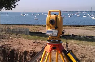
- Our team uses state-of-the-art GPS and robotic total station equipment.
- We maximize lot efficiency while maintaining neighborhood aesthetics.
- Our surveys guarantee compliance with state and municipal regulations.
- We provide customized solutions for residential, commercial, and municipal projects.
Services
Residential Land Surveying
Residential surveys ensure accurate property boundaries for real estate transactions, land division, and construction projects. Our state-compliant surveys include boundary, zoning location, and topographic assessments. Using advanced GPS technology, we deliver precise documentation to protect property investments and prevent disputes.
Commercial Land Surveying
Commercial surveying supports developers with subdivision design, construction layout, and regulatory compliance. We optimize lot configurations while maintaining aesthetic value and regulatory adherence. Our services include ALTA/ACSM surveys, topographic mapping, and GPS-based staking for industrial and commercial projects.
Hydrographic Surveying
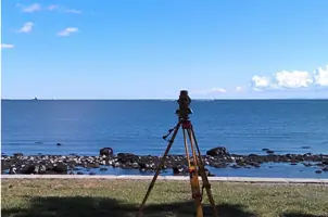
Hydrographic surveys map underwater terrain for coastal and inland water projects. We use specialized equipment to assess navigational safety, dredging needs, and environmental impacts. Our data supports port development, bridge construction, and aquatic habitat preservation in Connecticut's waterways.
Coastal Permitting
Coastal permitting services ensure compliance with environmental regulations for waterfront developments. We prepare documentation for tidal wetlands, floodplain management, and shoreline stabilization projects. Our expertise streamlines approvals from local, state, and federal agencies for coastal construction.
Subdivision Design
Subdivision design creates efficient lot layouts while preserving neighborhood character. We handle platting, utility planning, and regulatory submissions for residential and commercial developments. Our designs balance maximum land use with Connecticut's zoning requirements and environmental protections.
People
William W. Seymour
Founder
Founder of the firm in 1977, William W. Seymour established Connecticut's surveying standards. He served as president of the Connecticut Association of Land Surveyors and shaped state surveying regulations before his passing in 1997.
Jeffrey W. McDougal
President
President since 1997, Jeffrey W. McDougal continues the firm's legacy. With decades of experience, he oversees complex land development projects and maintains the company's commitment to technical excellence and client service.
Questions
What types of land surveys do you offer?
We provide residential boundary surveys, commercial ALTA/ACSM surveys, topographic mapping, hydrographic surveys, and subdivision designs for municipal and private clients.
How do you ensure survey accuracy?
We use GPS and robotic total stations with AutoCAD and Civil3D software to achieve precise measurements. Our team follows Connecticut's surveying standards and federal guidelines.
Do you handle coastal property surveys?
Yes, we specialize in coastal permitting and hydrographic surveys for waterfront properties, including tidal wetlands assessments and shoreline stabilization projects.
Can you assist with municipal land use applications?
We prepare regulatory submissions and site plans for local, state, and federal land use approvals, ensuring compliance with all environmental and zoning requirements.
What technology do you use?
Our equipment includes GPS systems, robotic total stations, and advanced mapping software. This technology enables efficient data collection and accurate 3D modeling for all project types.