Business Details
30 Years
experience
Trusted Land Surveying in Skaneateles, NY
PJO Survey is a family-owned, Service-Disabled Veteran Owned Business established in 1996, serving Skaneateles, Syracuse, and the greater Central New York region. Our co-owners, Paul Olszewski and John Legnetto, are licensed professional land surveyors and active members of the New York State Association of Professional Land Surveyors. We combine over 60 years of industry experience with cutting-edge technology from Leica Geosystems and DJI to deliver precise, efficient surveying solutions. Our commitment to trust, integrity, and family values drives every project, whether residential or commercial. We specialize in land surveying, 3D laser scanning, drone services, and building information modeling, ensuring accuracy and reliability.Our team prioritizes personalized service, fostering long-term client relationships built on professionalism and transparency. We actively collaborate with homeowners, attorneys, realtors, engineers, and contractors to meet diverse project needs. Recognized for our technical expertise and ethical standards, we aim to exceed client expectations through innovation and dedication. Our focus on quality extends to using advanced software and equipment, minimizing errors and project delays. For over 25 years, we have upheld a reputation for excellence, driven by our passion for the surveying profession and community service. Choosing PJO Survey means partnering with a team that values your time, budget, and satisfaction above all else.
Services
Land Surveying
Property Surveys
Flood Elevation Certificates
Septic Design Services
Subdivision Surveys
Topographic Surveys
Bathymetric Surveys
ALTA Surveys
3D Laser Scanning
Drone Services
Details
- Year established: 1996
Highlights and features
- Certified Service-Disabled Veteran Owned Business with 60+ years of combined experience.
- Utilize Leica Geosystems and DJI technology for unmatched accuracy and efficiency.
- Licensed surveyors and active members of New York State Association of Professional Land Surveyors.
- Family-owned focus on personalized service, transparency, and client satisfaction.
- Proven track record in complex residential and commercial land development projects.
Services
Land Surveying
Our land surveying services precisely determine property boundaries, easements, and legal descriptions using advanced GPS and total station technology. We cater to residential homeowners, real estate developers, and municipal projects. Our licensed surveyors ensure compliance with New York State regulations, providing reliable data for construction, zoning, and land transactions.
3D Laser Scanning
We capture detailed 3D models of structures and landscapes using high-accuracy LiDAR scanners, enabling precise measurements for architectural, engineering, and forensic applications. This technology reduces field time and minimizes human error. Clients receive comprehensive point cloud data for BIM integration, renovation planning, or accident reconstruction purposes.
Drone Services
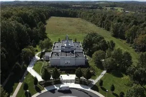
Our FAA-certified drone pilots conduct aerial photogrammetry and LiDAR mapping to create topographic maps, volumetric calculations, and progress monitoring for large-scale projects. Drones enhance safety and efficiency by accessing hard-to-reach areas. Data is processed into GIS-compatible formats for construction, environmental, and agricultural clients.
Building Information Modeling
We integrate 3D laser scans with BIM software to create dynamic digital representations of buildings, supporting architects and engineers throughout the construction lifecycle. This process improves collaboration, detects design conflicts early, and streamlines facility management. Our BIM models adhere to industry standards for commercial and industrial developments.
Flood Elevation Certificates
We provide FEMA-compliant elevation certificates to determine flood risk zones for properties in New York, essential for insurance requirements and floodplain management. Our surveys meet NFIP guidelines, helping homeowners and lenders assess flood vulnerability. Rapid turnaround times ensure compliance with mortgage and municipal deadlines.
People
Paul Olszewski
Owner
Licensed Professional Land Surveyor with 30+ years of experience in boundary, topographic, and construction surveys across New York State. Co-founder of PJO Survey, Paul combines technical expertise with a commitment to client satisfaction through transparent communication and quality control.
John Legnetto
Owner
Licensed surveyor specializing in ALTA/ACSM land title surveys and subdivision plats, bringing 25+ years of experience in municipal and private development projects. John ensures all deliverables meet strict regulatory standards while maintaining PJO Survey's focus on accuracy and timeliness.
PJ Wells
Crew Chief
Overseeing field operations, PJ coordinates survey teams and equipment logistics, ensuring efficient data collection for complex projects. With 15 years in the field, he bridges technical knowledge with practical problem-solving to maintain project timelines and data integrity.
Matthew Castrello
Certified Survey Technician
Certified by the National Society of Professional Surveyors, Matthew specializes in GPS data processing and CAD drafting, supporting both field and office workflows. His attention to detail ensures high-quality deliverables for residential and commercial clients across Central New York.
Gradon Ryan
Licensed Land Surveyor
Licensed in New York State, Gradon focuses on hydrographic surveys and floodplain mapping, utilizing sonar and drone technology for environmental and infrastructure projects. His expertise enhances PJO Survey's capabilities in water resource management and FEMA-related work.
Questions
What services does PJO Survey offer?
We provide land surveying, 3D laser scanning, drone mapping, flood elevation certificates, subdivision surveys, and building information modeling for residential and commercial clients.
Are you a veteran-owned business?
Yes, PJO Survey is a Certified Service-Disabled Veteran Owned Business (SDVOB) established in 1996 by Paul Olszewski and John Legnetto.
What areas do you serve?
We operate throughout Central New York, including Skaneateles, Syracuse, and surrounding counties, with capabilities for statewide projects.
How can I request a quote?
Contact us via phone at 315-488-5552 or through our website's contact form to discuss your project and receive a customized quote.
Do you use advanced surveying technology?
Yes, we utilize Leica Geosystems equipment, DJI drones, and specialized software to ensure high accuracy and efficiency for every project.