Business Details
21 Years
experience
Professional Surveying & Mapping Services in Greensboro, NC
Sacks Surveying & Mapping was established in 2005 in Greensboro, North Carolina, building on over three decades of regional expertise since 1985. Our team specializes in commercial, industrial, boundary, topographic, construction, subdivision, and mapping projects, delivering precision and reliability to clients across real estate, construction, and engineering sectors. We operate as a Professional Corporation under North Carolina General Statutes Chapter 55b, maintaining rigorous standards of professionalism and technical excellence. With licensed operations in North Carolina, South Carolina, Virginia, Delaware, and West Virginia, we extend our services through strategic partnerships in Tennessee, Arkansas, Louisiana, California, Illinois, and Ohio.Our commitment to consistent value, quality service, and long-term client relationships drives every project, supported by advanced technologies like LiDAR, photogrammetry, and digital twin modeling. We prioritize employee satisfaction and community engagement through civic involvement, ensuring our work positively impacts both clients and society. Backed by affiliations with industry-certifying bodies, we uphold the highest ethical and technical standards in land surveying.
Services
ALTA/NSPS Surveys
Boundary Surveys
Construction Staking
3D Laser Scanning
Geo-Referenced Mapping
Volume Monitoring
Digital Twin Modeling
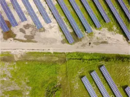
Solar Farm Layouts
Details
- Year established: 2005
Highlights and features
- We offer 35+ years of regional surveying expertise since 1985.
- Our team uses advanced LiDAR and photogrammetry technologies.
- We maintain professional certifications under NC General Statutes.
- We serve clients across six states with scalable solutions.
- Our focus on community engagement ensures local market understanding.
Services
ALTA/NSPS Surveys
We conduct ALTA/NSPS land title surveys to meet national standards for commercial property transactions. Our surveys identify boundaries, easements, and improvements with high accuracy. Clients receive detailed documentation for title insurance and development planning.
3D Laser Scanning
Our 3D laser scanning creates precise point cloud models for construction and industrial sites. This technology captures millions of data points for as-built documentation. Clients use these models for design validation and facility management.
Construction Staking
We provide construction staking to guide accurate project implementation. Our team marks precise locations for buildings, utilities, and infrastructure. Contractors rely on our staking for compliance with design specifications.
Geo-Referenced Mapping
Our geo-referenced orthomosaic maps combine aerial imagery with survey-grade accuracy. These high-resolution maps support land development and environmental monitoring. Clients access scalable digital deliverables for project tracking.
Volume Monitoring
We perform volume monitoring for stockpile and earthwork calculations. Using LiDAR and photogrammetry, we measure material quantities with 1% accuracy. Clients track project progress and manage resources efficiently.
Questions
What areas do you serve?
We operate in North Carolina, South Carolina, Virginia, Delaware, and West Virginia, with joint ventures in six additional states.
What surveying technologies do you use?
We employ LiDAR, photogrammetry, 3D laser scanning, and hybrid SLAM processing for precise data collection.
Are you licensed professionals?
Yes, we're a North Carolina Professional Corporation with licensed surveyors across multiple states.
How do you handle large-scale projects?
Our GeoSiteTrack system provides scalable monitoring with weekly updates or single mobilizations as needed.
What industries do you work with?
We serve commercial real estate, construction, energy, and industrial clients with tailored surveying solutions.