Business Details
26 Years
experience
Trusted Surveying Services in Tyrone, GA
WD Gray & Associates has been a leading surveying company in the Metro Atlanta Area since January 2000. Founded by Warren Gray, our team includes three registered land surveyors who bring decades of combined experience and expertise to every project. From residential lot surveys to major commercial developments, we utilize advanced equipment and methodologies to deliver precise, reliable results. Our commitment to quality is reflected in over 25,000 completed work orders and testimonials praising our professionalism, efficiency, and client-focused approach.We pride ourselves on handling projects of all sizes with equal care, ensuring client satisfaction through transparent communication and adherence to industry standards. Our extensive portfolio includes diverse projects such as large-scale boundary surveys, infrastructure developments, and specialized services like drone-based aerial mapping. With a focus on innovation and accuracy, we continue to serve as a trusted partner for property owners, developers, and institutions across Georgia.

Services
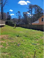
Property Corner Staking
ALTA Survey
Drone Services
Erosion Control Plan
House Staking
Topographic Survey
Final Plat Subdivision
Grade Staking
Flood Elevation Certificate
Details
- Year established: 2000
Highlights and features
- We have over 20 years of experience in Georgia land surveying.
- Our team includes three registered land surveyors with specialized expertise.
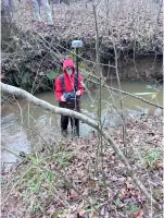
- We utilize advanced RTK GPS and robotic total station technology.
- We provide transparent pricing and timely project completion.
- We maintain a proven track record with 25,000+ completed projects.
What people say
Timely manner
Professional and honest
Knowledgeable and professional
Transparent with pricing
Superior service
Services
Residential Survey
We provide comprehensive residential surveying solutions including property corner staking, boundary determination, and flood elevation certificates. Our services ensure accurate land records for property transactions, construction projects, and dispute resolution. Clients benefit from rapid turnaround times and precise documentation meeting all regulatory requirements.
Commercial Survey
Our commercial survey services include ALTA/NSPS standards surveys, construction layout, and infrastructure staking for large-scale developments. We support projects ranging from industrial facilities to mixed-use complexes with detailed topographic mapping and boundary analysis. Clients receive actionable data for permitting, design, and construction phases.
Drone Services
We offer licensed drone-based surveying for aerial topography, mapping, and construction monitoring. Our UAS technology captures high-resolution data for site analysis, progress tracking, and volumetric calculations. This service provides cost-effective, detailed insights for both residential and commercial projects.
Erosion Control Plan
We create erosion control plans for developments under one acre, ensuring compliance with environmental regulations. Our plans integrate with site development proposals to manage stormwater runoff effectively. Clients receive actionable documentation for permitting and construction phases.
ALTA Survey
Our ALTA/NSPS land title surveys meet the highest industry standards for commercial property transactions. We identify boundary details, easements, and encroachments to satisfy lender and title insurance requirements. Clients benefit from thorough documentation reducing transaction risks.
People
Warren Gray
Founder
With over 35 years in surveying, Warren Gray established the company in 2000. He maintains active involvement in project execution and client relations while ensuring technical excellence across all operations.
Matt Langley
Registered Surveyor
Joining in 2003, Matt Langley became a licensed surveyor in 2010. He specializes in complex boundary analysis and construction layout, bringing technical expertise to both residential and commercial projects.
Questions
What types of surveying services do you offer?
We provide residential and commercial surveying services including boundary determination, construction layout, ALTA surveys, drone mapping, and erosion control plans across Georgia.
How quickly can you complete a residential survey?
Most residential surveys are completed within one day, with final documentation delivered promptly following fieldwork and office processing.
Do you serve areas outside Metro Atlanta?
While based in Tyrone, we serve all of Georgia including Fayette, Coweta, Meriwether, Pike, and Troup counties for both residential and commercial projects.
What equipment do you use for surveys?
We utilize RTK GPS systems, robotic total stations, digital levels, and licensed drone technology to ensure precise, efficient data collection for all project types.
How do I request a quote?
Contact us via phone or email with property details and parcel number. We provide free estimates after reviewing your specific surveying requirements.