
Business Details
14 Years
experience
Emergency
services
Your Trusted Partner for Geospatial Data Solutions
At SAM, we deliver fast, accurate geospatial data to empower clients to advance their programs with confidence. With decades of combined experience across our leadership team, we specialize in mapping, data collection, inspection, and digital solutions that form the foundation for infrastructure success. Our expertise spans land surveying, aerial mapping, GIS, BIM/3D laser scanning, and subsurface utility engineering, supported by advanced technologies and certified professionals. Recognized nationally for 13 consecutive years, we prioritize innovation, collaboration, and client-centric service, ensuring projects meet rigorous safety and compliance standards.Our teams deploy within 24 hours, operating nationwide with localized expertise in critical sectors like utilities, transportation, and government. By transforming raw data into actionable insights, we help clients mitigate risks, optimize assets, and achieve long-term sustainability. Our culture of inclusion and continuous improvement drives technological progress while maintaining trust through transparent communication and ethical practices.

Services
Land Surveying
Aerial Mapping
GIS Consulting
BIM/3D Laser Scanning
Subsurface Utility Engineering
Powerline Inspection
Digital Twins
Damage Prevention
Construction Monitoring
Utility Coordination
Details
- Year established: 2012
Highlights and features
- We deploy teams within 24 hours for rapid data collection and project execution.
- Our certified experts utilize advanced technologies like LiDAR and 3D laser scanning.
- Recognized nationally for 13 consecutive years in ENR's Top 500 Design Firms.
- Specialized in high-risk infrastructure projects with strict safety compliance standards.
- Offer end-to-end solutions from initial surveys to enterprise-level data management.
What people say
Top Workplace recognition
Expertise in geospatial data
Advanced technologies
13 years of recognition
Services
Land Surveying
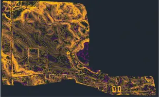
SAM provides precise land surveying for infrastructure projects, using GPS and LiDAR to establish accurate property boundaries and topographic data. Our services support construction, utilities, and transportation sectors by ensuring compliance with regulatory standards. With rapid deployment capabilities, we deliver actionable insights for site planning and development.
Aerial Mapping
Our aerial mapping services utilize drones and high-density LiDAR to capture detailed site data for large-scale projects. This technology enables efficient terrain modeling, asset management, and progress tracking across industries. Clients benefit from faster data acquisition and reduced field time while maintaining high accuracy for engineering and planning purposes.
GIS Consulting
SAM's GIS consulting transforms raw geospatial data into strategic decision-making tools. We develop customized mapping solutions for utilities, government, and transportation clients to optimize asset management and infrastructure planning. Our expertise includes substation digital twins and utility coordination, enhancing operational efficiency through integrated spatial data systems.
Subsurface Utility Engineering
We specialize in subsurface utility engineering to locate and map underground infrastructure using ground-penetrating radar and electromagnetic detection. This service minimizes risks during construction projects by identifying hidden utilities. Our SUE services ensure safety, reduce excavation costs, and support compliance with federal and local regulations for utilities and transportation sectors.
Digital Twins
SAM creates digital twins of infrastructure assets using BIM and 3D laser scanning technologies. These virtual replicas enable real-time monitoring, predictive maintenance, and scenario planning for utilities and industrial facilities. By integrating GIS data, we provide clients with scalable digital solutions to enhance asset lifecycle management and operational efficiency.
People
Matthew Reinhart
Mid-East Director of Transportation
Matthew Reinhart, P.E., brings extensive engineering expertise to SAM as Mid-East Director of Transportation, specializing in infrastructure project management and strategic planning.
Chris Zmijewski
Field Crew Supervisor
Chris Zmijewski leads field operations in Richmond, Virginia, with a focus on surveying technology and team training for large-scale data center projects.
Questions
What geospatial services does SAM offer?
SAM provides land surveying, aerial mapping, GIS consulting, subsurface utility engineering, digital twins, and inspection services for infrastructure and utility projects.
How quickly can SAM deploy teams for projects?
SAM teams deploy within 24 hours to begin data collection, ensuring rapid response for time-sensitive infrastructure needs nationwide.
What industries does SAM serve?
We support utilities, transportation, government, and industrial clients with geospatial solutions for power generation, roadways, bridges, and more.
Does SAM handle large-scale infrastructure projects?
Yes, our expertise spans local route surveys to multibillion-dollar programs, combining advanced technology with experienced professionals for complex projects.
How does SAM ensure data accuracy?
We use LiDAR, 3D laser scanning, and GPS technologies alongside certified professionals to deliver precise, actionable geospatial insights.