Business Details
Professional Surveying Services in Chesapeake, VA
Align Surveying & Design, P.C has established itself as a trusted provider of comprehensive surveying solutions for both public and private sectors. With expertise in land development projects, construction stakeout, and specialized surveys like ALTA/ACSM and flood elevation certificates, we combine advanced technology with precision to deliver reliable results. Our team prioritizes client satisfaction by ensuring projects are completed on schedule and within budget. We specialize in boundary surveys, topographic mapping, and machine control modeling while maintaining a commitment to quality and accuracy.Our services support residential and commercial clients navigating property development challenges, including wetlands, terrain complexities, and regulatory requirements. By focusing on clear communication and technical excellence, we empower clients to make informed decisions about their properties. Our dedication to professional standards and client-centric service positions us as a leader in the surveying industry.
Services
Mortgage Surveys
Elevation Certificates
Topographic Surveys
ALTA Surveys
Boundary Surveys
Construction Stakeout
Hydrographic Surveys
Railroad Surveys
Volume Calculations
Condominium Exhibits
Highlights and features
- We specialize in ALTA/ACSM land title surveys for commercial properties
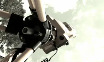
- Our team employs robotic total stations and GPS-RTK technology
- Experienced in Chesapeake Bay Preservation Act compliance mapping
- Provide 3D machine control modeling for construction projects
- Offer specialized wetland delineation and CBPA mapping services
Services
Mortgage Surveys
Physical boundary surveys required for property transactions and mortgage lending. Our team locates property corners, identifies encroachments, and prepares detailed plat maps. This service helps homeowners and lenders verify property dimensions and legal descriptions during real estate transactions.
Elevation Certificates
Flood risk documentation for insurance and compliance purposes. We determine building elevations relative to flood zones and provide FEMA-compliant certificates. This service helps property owners secure accurate flood insurance rates and meet regulatory requirements in coastal areas.
Construction Stakeout
Precision layout services for infrastructure and building projects. Our surveyors mark exact locations for foundations, utilities, and roadways using advanced GPS equipment. This ensures proper alignment and grading for construction projects ranging from residential developments to commercial facilities.
ALTA Surveys
Comprehensive boundary surveys meeting national standards for commercial properties. We identify easements, encroachments, and improvements while verifying legal descriptions. This service provides detailed property information for title insurance and real estate transactions.
Topographic Surveys
Detailed terrain mapping for engineering and development projects. We capture elevation data, natural features, and man-made structures to create accurate site models. This service supports drainage analysis, site planning, and construction design for residential and commercial properties.
Questions
What types of surveys do you specialize in?
We specialize in mortgage surveys, ALTA/ACSM land title surveys, elevation certificates, topographic mapping, construction stakeout, and Chesapeake Bay Preservation Act compliance surveys.
How long does a typical survey take?
Most residential surveys take 2-4 weeks depending on terrain complexity and seasonal conditions. Commercial projects may require additional time based on scope and regulatory requirements.
Do you serve both residential and commercial clients?
Yes, we provide surveying services for both residential property owners and commercial developers across Virginia and North Carolina.
What technology do you use?
We utilize robotic total stations, GPS-RTK systems, and 3D machine control modeling to ensure precision and efficiency in all surveying projects.
How are survey costs determined?
Costs depend on property size, terrain complexity, required research, and seasonal conditions. We provide customized quotes after reviewing specific project requirements.
Are you licensed in multiple states?
Our primary operations are in Virginia with experience working on projects in North Carolina, adhering to both states' surveying regulations and standards.