Business Details
34 Years
experience
Professional Surveying Services in Merritt Island
Land & Sea Surveying has been a leader in advanced surveying solutions since 1992, combining cutting-edge technology with over a century of cumulative expertise. Our team of licensed surveyors, technicians, and engineers delivers precise data for land, marine, and aerial projects across Florida and beyond. We maintain rigorous quality control while adapting to industry innovations, ensuring clients receive actionable insights for critical decision-making. With specialized capabilities in hydrographic, topographic, and drone surveying, we serve government agencies, engineering firms, and private clients with unmatched technical proficiency. Our founder, Tim Carlile, established the company on principles of excellence, holding multiple state surveyor licenses and maritime certifications.We invest continuously in equipment upgrades, including multibeam sonar systems and FAA-certified drones, to maintain our position as one of Florida's most technologically advanced firms. Our veteran-owned status and pre-qualification with the Florida Department of Transportation underscore our commitment to public sector excellence. Client success drives our approach, whether mapping submerged utilities or supporting coastal infrastructure projects. We maintain long-term partnerships through transparent communication and adherence to federal and state small business standards. This dedication has sustained continuous service contracts with major entities like Port Canaveral since 2015.
Services
Hydrographic Surveying
Land Surveying
Drone Mapping
Subsurface Utility Location
Topographic Surveys
Details
- Year established: 1992
Highlights and features
- Over 100 combined years of surveying expertise
- Investment in cutting-edge multibeam sonar and drone technology
- Team includes FAA-certified remote pilots and USCG-licensed captains
- Pre-qualified for Florida Department of Transportation projects
- Continuous service contracts with Port Canaveral since 2015
Associations and certifications
- HYPACK Certified Hydrographer
- Registered Professional Surveying Firm (FL)
- Certified Veteran-Owned Business (FL)
Services
Hydrographic Surveying
Our hydrographic surveying services utilize multibeam and singlebeam sonar systems to map underwater terrain with millimeter-level accuracy. We support dredging operations, port infrastructure, and environmental assessments by creating detailed bathymetric charts. Clients benefit from our USCG-certified vessels and experienced dive teams for submerged structure inspections.
Drone Surveying
FAA-certified drone operations capture high-resolution aerial imagery for topographic mapping and construction monitoring. Our WingtraOne and DJI Phantom 4 Pro drones generate geo-referenced orthophotos and 3D models covering up to 960 acres per flight. This technology provides cost-effective data collection for large-scale coastal and infrastructure projects.
Land & Sea Surveying
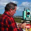
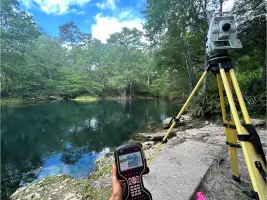
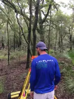
We conduct boundary, topographic, and construction layout surveys using robotic total stations and RTK GPS systems. Our services support residential developments, commercial properties, and public infrastructure projects. Clients receive precise measurements for legal documentation and engineering design across six southeastern states.
Subsurface Utility Location
Advanced ground-penetrating radar and electromagnetic locators identify underground utilities without excavation. We perform confined space entry surveys for manhole mapping and provide as-built documentation for utility networks. This service prevents costly strikes during construction projects in urban and industrial areas.
Topographic Surveys
Detailed topographic surveys document natural and man-made features for site planning and engineering design. We combine traditional surveying with drone photogrammetry to create digital elevation models. Clients use these surveys for drainage analysis, permit applications, and construction documentation across diverse terrains.
People
Tim Carlile
Founder and President
Licensed surveyor in six states with 44+ years of experience. USCG captain and FAA-certified drone pilot. Developed company's technological capabilities since founding in 1992. Expert in hydrographic and boundary surveying.
Suzanne Carlile
Office Manager
Manages accounting and operations with 20+ years of experience. Certified in multibeam hydrographic systems. Combines financial expertise with field surveying knowledge to ensure project efficiency.
Scott Sharpe
Marine Instrumentation Specialist
25+ years of ocean engineering experience. HYPACK-certified hydrographer with expertise in bathymetric systems. Manages complex marine data collection projects and equipment calibration.
Michael Carlile
CAD Manager
Geomatics student with hands-on experience in surveying technology. Manages drafting operations and supports field data integration. Holds multiple maritime and drone certifications.
Timothy Carlile
Lead Survey Technician
6+ years of field experience with expertise in robotic total stations and multibeam systems. USCG-licensed captain with hydrographic surveying specialization. Supports both land and marine projects.
Questions
What geographic areas do you serve?
We primarily serve Florida counties including Brevard, Miami-Dade, and Broward, with capabilities extending to coastal projects across the Gulf Coast and southeastern United States.
Are your surveyors licensed?
Yes, our team includes Professional Land Surveyors licensed in six states and the US Virgin Islands, along with FAA-certified drone operators and USCG-licensed captains.
What technologies do you use?
We employ multibeam sonar systems, RTK GPS, robotic total stations, and FAA-certified drones including the WingtraOne and DJI Phantom 4 Pro for comprehensive data collection.
How do you handle underwater surveys?
Our hydrographic surveys use specialized vessels equipped with singlebeam/multibeam sonar. We combine this with dive team inspections and side-scan sonar for submerged structure assessments.
Can you perform utility location services?
Yes, we use ground-penetrating radar and electromagnetic locators for non-invasive utility mapping, including confined space entry surveys for manhole networks.
What industries do you work with?
We serve government agencies, engineering firms, and private clients on infrastructure, environmental, and maritime projects including port developments and coastal restoration.