
Business Details
31 Years
experience
Expert Surveying & Mapping Services in Lakeland, FL
Porter GPS has been a leader in professional surveying and mapping in Polk County, Florida, for over 30 years. Our team combines over 100 years of collective experience in delivering high-quality, detail-oriented services to residential and commercial clients. We specialize in ALTA/Title Surveys, Subdivision Platting, and As Built Surveys, utilizing state-of-the-art technology to ensure precision. Our commitment to innovation is evident in our adoption of aerial mapping services using drones, enhancing project accuracy and efficiency. We serve Lakeland, Polk City, Highland City, and surrounding areas, maintaining a reputation for reliability and technical excellence. Founded in 1995 by Mark D. Porter, who has over 50 years of industry experience, we prioritize client satisfaction through transparent communication and adherence to regulatory standards.Our services include boundary surveys, topographic mapping, and construction stakeout, tailored to meet diverse project needs. We collaborate with civil engineers and environmentalists to deliver comprehensive solutions, from environmental wetlands mapping to GPS control setting. Our dedication to continuous improvement ensures clients receive cutting-edge services that meet evolving industry demands. With thousands of completed projects and a focus on personalized service, Porter GPS remains a trusted partner for surveying needs in Central Florida.

Services
ALTA/Title Surveys
Subdivision Platting
As Built Surveys
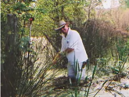
Environmental and Wetlands Location
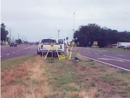
GPS Control
Topographic Surveys
Boundary Survey
Legal Description
Construction Stakeout/Layout
Drones for Aerial Surveying
Details
- Year established: 1995
Highlights and features
- We offer over 30 years of experience in professional surveying and mapping.
- Our team has over 100 years of combined experience in the field.
- We utilize state-of-the-art technology, including drone-based aerial mapping.
- We serve both residential and commercial clients across Polk County.
- Our founder has over 50 years of industry expertise and technical knowledge.
Services
ALTA/Title Surveys
ALTA/Title Surveys provide detailed land data for title companies and lenders, ensuring compliance with ALTA specifications. These surveys support mortgage insurance issuance by mapping property boundaries and improvements. Our team adheres to strict standards for accuracy and regulatory alignment.
Subdivision Platting
Subdivision Platting involves designing new lots with infrastructure planning for roads, utilities, and drainage. We collaborate with engineers to draft and submit plats for government approval, ensuring legal compliance and optimal land use for developers.
As Built Surveys
As Built Surveys verify the location and elevation of existing structures to ensure regulatory compliance. Using advanced equipment, we assess construction accuracy, helping clients confirm that projects meet design specifications and local codes.
Environmental and Wetlands Location
Environmental and Wetlands Location services map shorelines and sensitive areas with precision. We work alongside environmentalists to locate wetland flags, supporting ecological assessments and regulatory reporting for land development projects.
Drones for Aerial Surveying
Drones for Aerial Surveying enable efficient topographic mapping and construction monitoring. Our drone technology captures high-resolution imagery for volume analysis and progress tracking, offering cost-effective solutions for large-scale projects and site documentation.
People
Mark D. Porter
Founder
Mark D. Porter founded Porter GPS in 1995, bringing over 50 years of surveying experience. His expertise in advanced technology and commitment to client satisfaction have established the company as a leader in Polk County's surveying industry.
Questions
What services does Porter GPS offer?
We provide ALTA/Title Surveys, subdivision platting, as-built surveys, environmental mapping, drone-assisted aerial surveys, and more for residential and commercial clients.
How long has Porter GPS been in business?
Porter GPS has served Polk County since its founding in 1995 by Mark D. Porter, who has over 50 years of surveying experience.
Do you use drone technology for surveys?
Yes, we offer aerial mapping services using drones for topographic surveys, construction monitoring, and volume analysis.
What areas do you serve?
We serve Lakeland, Polk City, Highland City, Mulberry, Auburndale, Winter Haven, and surrounding areas in Polk County, Florida.