
Business Details
Your Trusted Civil Engineering Partner in Lakeland
CivilSurv Design Group has been delivering innovative engineering solutions for decades, combining technical expertise with a commitment to community impact. Our team of licensed professionals specializes in civil engineering, surveying, transportation planning, and advanced mapping technologies to serve public and private sector clients. With offices in Lakeland, Vero Beach, Port St. Lucie, and Sebring, we prioritize local knowledge while maintaining statewide reach. Our engineers and surveyors bring decades of combined experience in water/wastewater systems, roadway design, subsurface utility engineering, and construction management. We emphasize precision through technologies like terrestrial LiDAR and photogrammetry while maintaining traditional surveying excellence.Our leadership team includes certified professionals with specialized credentials in environmental planning, project management, and FAA-certified drone operations. We focus on creating cost-effective, sustainable infrastructure solutions that meet regulatory requirements and exceed client expectations. Our track record with FDOT-certified projects demonstrates our technical proficiency and adherence to industry standards. Client partnerships with agencies like Polk County highlight our ability to deliver complex projects on time and within budget. Backed by 40+ years of collective experience, we remain dedicated to advancing engineering practices while maintaining personalized service.

Services
Civil Engineering
Subsurface Utility Engineering
Surveying & Mapping
Terrestrial LiDAR
Transportation Engineering
Construction Inspection
Urban Planning
Highlights and features
- We offer 40+ years of combined engineering and surveying expertise
- Our team includes FDOT-certified professionals with specialized credentials
- We implement advanced LiDAR and drone technologies for precision mapping
- Our FAA-certified pilots conduct safe, efficient aerial surveys
- We maintain 100% client satisfaction with Polk County partnerships
Associations and certifications
- Small Business Enterprise
What people say
Quality of work
Levels of comfort
Confidence
No disappointment
Future contract considerations
Services
Civil Engineering
Our civil engineering team delivers comprehensive solutions for water/wastewater systems, roadway projects, and site developments. We specialize in master planning, system rehabilitation, and regulatory compliance for municipal and private clients. With FDOT-certified professionals, we ensure projects meet technical standards while addressing community needs through sustainable design practices.
Subsurface Utility Engineering
We prevent construction conflicts through advanced subsurface utility detection and mapping. Our SUE services reduce project risks by identifying buried infrastructure before design begins. Using ground-penetrating radar and vacuum excavation, we create accurate utility models that minimize redesign costs and enhance worksite safety for transportation and development projects.
Terrestrial LiDAR
Our LiDAR technology creates precise 3D models for pre-construction planning and as-built documentation. This non-contact measurement system captures complex environments with millimeter accuracy, reducing field revisits. Applications include roadway corridor mapping, mechanical equipment modeling, and archaeological documentation under professional surveyor supervision.
Transportation Engineering
We provide full-spectrum transportation engineering services including highway design, traffic studies, and signalization planning. Our FDOT-certified team handles projects from conceptual design through construction administration. Expertise includes safety improvements, drainage solutions, and compliance with federal transportation funding requirements for municipal and state infrastructure projects.
Construction Inspection
Our construction engineering inspection ensures projects meet design specifications and quality standards. We provide on-site monitoring, materials testing, and compliance verification for public works projects. With LAP/ARRA grant experience, we help clients maintain funding compliance while ensuring construction accuracy through detailed documentation and field surveys.
People
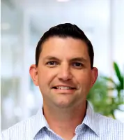
Craig Fuller
President
Licensed professional engineer with extensive water/wastewater project management experience. Specializes in hydraulic modeling and reclaimed water system design. Leads technical teams while maintaining active involvement in project design and permitting processes.
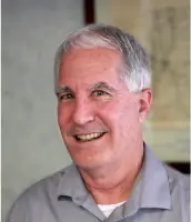
Ken Glass
Vice President of Surveying and Mapping
Certified surveying expert with decades of GPS and digital terrain modeling experience. Oversees advanced mapping operations including LiDAR integration and photogrammetry applications for infrastructure projects across Florida.
Mark Frederick
Vice President of Civil Engineering
Licensed engineer with environmental and project management certifications. Directs multidisciplinary teams on roadway improvements, stormwater systems, and public-private development projects while ensuring regulatory compliance and technical excellence.
Tim Morris
Vice President of Geomatics
FAA-certified drone pilot with 20+ years in surveying and LiDAR technology. Manages geospatial data collection and processing for complex infrastructure projects, integrating traditional and remote sensing techniques under professional surveyor oversight.
John Howle
Principal Engineer
Civil engineering veteran since 1975 with expertise in transportation design and agency permitting. Provides end-to-end project leadership from planning through construction for roadway, drainage, and utility infrastructure projects across Florida.
Questions
What engineering services does CivilSurv offer?
We provide civil engineering, transportation design, subsurface utility mapping, LiDAR scanning, and construction management services for public infrastructure and private development projects.
Are your engineers certified by Florida agencies?
Yes, our team includes FDOT-certified professionals with credentials in major highway design, traffic engineering, and construction inspection.
How does your LiDAR technology benefit projects?
Our terrestrial LiDAR creates precise 3D models that improve design accuracy, reduce field revisits, and enhance safety by capturing data remotely.
Do you work outside Lakeland?
We serve clients across Florida with offices in Lakeland, Vero Beach, Port St. Lucie, and Sebring while maintaining local regulatory expertise.
Can you handle federally funded projects?
Yes, we have experience with LAP, ARRA, and other grant-funded projects including compliance documentation and federal reporting requirements.
What makes your SUE services unique?
Our SUE team combines professional engineering and surveying credentials to deliver cost-saving utility mapping that reduces construction risks by 4.62:1 according to industry studies.