Business Details
47 Years
experience
Professional Land Surveying Services in DeLand, FL
Blackwell Surveying has been delivering professional land surveying services in Central Florida since 1979. Our firm combines decades of experience with the largest historical survey record archive in Volusia County, dating back to 1886. We specialize in boundary surveys, construction layout, topographic surveys, and land subdivision for residential, commercial, and governmental clients. Our team of registered Professional Land Surveyors utilizes advanced technology while maintaining a commitment to accuracy and integrity. We prioritize client satisfaction through on-time delivery, budget adherence, and comprehensive service from project conception to completion.Our core values emphasize results, integrity, camaraderie, education, innovation, and gratitude. With offices in DeLand, Florida, we serve Volusia, Lake, and Flagler Counties. Our expertise in GPS surveying, data collection, and conventional techniques ensures reliable solutions for complex projects. We maintain Professional Liability Insurance for all surveying services. Our legacy of excellence continues through dedicated professionals who uphold the standards established by our founder.
Services
Boundary Surveys
Construction Layout
Topographic Surveys
Land Subdivision
Legal Descriptions
Road Surveys
Utility Surveys
As-Built Surveys
Mortgage Surveys
Special Purpose Surveys
Details
- Year established: 1979
Highlights and features
- We have over 40 years of experience in Central Florida land surveying
- We maintain the largest historical survey record archive in Volusia County
- Our services are completed on time and within budget constraints
- Our team includes two registered Professional Land Surveyors & Mappers
- We combine cutting-edge technology with traditional surveying expertise
Services
Boundary Surveys
Our boundary surveys establish precise property lines using historical records and modern technology. We analyze deeds, maps, and legal descriptions to resolve disputes and prepare properties for development. Clients receive detailed documentation meeting Florida surveying standards.
Construction Layout
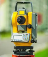
We provide accurate construction layout services for residential and commercial projects. Our team marks building corners, utilities, and infrastructure to ensure proper alignment with plans. GPS and robotic instruments guarantee precision throughout the construction process.
Topographic Surveys
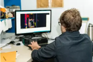
Our topographic surveys capture natural and man-made features with elevation data. This information supports site planning, drainage analysis, and engineering designs. We use advanced equipment to create detailed contour maps and digital terrain models.
Land Subdivision
We assist with legal land division through subdivision surveys. Our process includes boundary analysis, plat preparation, and coordination with local governments. Clients receive compliant documentation for creating new parcels or adjusting existing boundaries.
As-Built Surveys
Our as-built surveys verify completed construction matches approved plans. We document actual improvements for record keeping and future projects. These surveys ensure compliance with permits and provide accurate data for property management.
People
Ralph E. Blackwell
Founder
Ralph Blackwell established the company in 1979 through a merger of two surveying firms. His leadership created a legacy of accuracy and integrity that continues today. He built the largest historical survey record archive in Volusia County.
Constance F. Blackwell
President
Connie Blackwell has been integral to company operations since 1965. She maintains her husband's legacy of integrity while overseeing business operations. Her leadership ensures continued excellence in client service and professional standards.
Robert Evers
Field Services Supervisor
Bob Evers has led field operations since 2009 with 25+ years of surveying experience. Certified since 1997, he specializes in boundary, topographic, and right-of-way surveys. His expertise ensures accurate data collection across diverse projects.
Megan Blackwell
Client Services Manager
Megan Blackwell manages office operations and client coordination. She oversees financial processes and daily administrative functions. Her organizational skills ensure smooth project execution from initial contact to final delivery.
Questions
What surveying services do you offer?
We provide boundary surveys, construction layout, topographic surveys, land subdivision, legal descriptions, road and utility surveys, and as-built documentation for residential, commercial, and government clients.
How long have you been in business?
Blackwell Surveying has provided professional land surveying services in Central Florida since 1979, with over 40 years of continuous operation.
What areas do you serve?
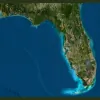
We primarily serve Volusia County with additional services in Lake and Flagler Counties. Our historical survey records focus on West Volusia County properties.
Are your surveys insured?
Yes, all our surveying services include Professional Liability Insurance coverage to protect both our clients and our firm during project execution.
What technology do you use?
Our team utilizes GPS surveying, robotic instruments, and advanced data collection systems while maintaining traditional surveying techniques for comprehensive project solutions.
Can you handle government projects?
Yes, we have extensive experience with municipal, county, and state agencies including the Volusia County School Board and Florida Department of Environmental Protection.