Business Details
Trusted Engineering and Land Surveying Services in Elyria, OH
At KS Associates, we are dedicated to delivering high-quality engineering and land surveying solutions tailored to meet the unique needs of our clients. With specialized expertise in coastal engineering, site development, and water systems, we combine technical excellence with a commitment to ethical practices and community engagement. Our team of certified professionals utilizes advanced technologies like 3D laser scanning to provide accurate, cost-effective services across diverse markets including municipal, residential, and transportation sectors.We prioritize client relationships, ensuring projects are completed with minimal risk and maximum value through comprehensive planning, design, and construction oversight. Our decades of experience serving Ohio and beyond have established us as a trusted partner in infrastructure development and environmental stewardship.
Services
Coastal Engineering
Land Surveying
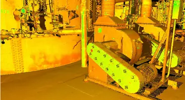
3D Reality Capture
Municipal Engineering
Site Development
Water Systems Design
Construction Inspection
Nature-Based Shorelines
Hydrographic Surveys
Drone Technology
Highlights and features
- We offer specialized coastal engineering expertise with Ohio's largest in-house team.
- Our 3D laser scanning technology ensures precise surveying and modeling solutions.
- Certified SBE/WBE/FBE status demonstrates commitment to diversity and inclusion.
- Decades of municipal project experience with proven regulatory compliance success.
- Integrated construction administration services protect client interests throughout project delivery.
Associations and certifications
- SBE
- WBE
- FBE
What people say
Technical expertise
Regulatory compliance
Advanced technology
Client-focused approach
Project efficiency
Services
Coastal Engineering
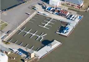
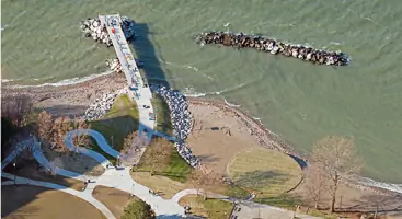
Our coastal engineering services focus on waterfront infrastructure improvement along Great Lakes and inland waterways. We specialize in erosion protection, nature-based shorelines, and regulatory permitting for projects like breakwaters, marinas, and dredging operations. With Ohio's largest in-house coastal team, we deliver solutions that balance environmental stewardship with structural integrity.
3D Reality Capture
This service provides high-definition 3D modeling of existing sites using laser scanning and photogrammetry. We create accurate AutoCAD/Revit models for adaptive reuse, MEP renovations, and historical documentation. The technology reduces redesign risks and enables virtual site visits, improving project accuracy and cost efficiency for architects and contractors.
Municipal Engineering
We support municipalities with water, sewer, and storm drainage system design and rehabilitation. Our services include planning, construction administration, and funding assistance for public works projects. With former city engineers on staff, we understand local government needs and deliver cost-effective solutions that enhance community quality of life.
Land Surveying
Our surveying division offers boundary, topographic, and hydrographic surveys using state-of-the-art equipment. Services include ALTA/ACSM surveys, right-of-way mapping, and construction staking. The team's expertise in 3D scanning and drone technology ensures precise data collection for complex infrastructure projects across Northeast Ohio.
Site Development
We provide comprehensive site engineering for residential, commercial, and institutional developments. Services cover stormwater management, roadway design, and environmental compliance from concept through construction. Our engineers address zoning challenges, floodplain issues, and utility coordination to create functional, code-compliant developments that maximize land use potential.
People
Lynn S. Miggins
President
As President and former City Engineer, Lynn brings deep municipal expertise to KS Associates. With P.E. certification and decades of Ohio infrastructure experience, she leads public works projects while maintaining the firm's founding values of client focus and community service.
Mark P. Cencer
Director of Coastal Engineering Services
Mark leads our specialized Coastal Engineering Group, combining technical expertise with regulatory knowledge. He oversees projects involving erosion control, marine structures, and environmental permitting along Ohio's waterways, ensuring compliance with federal and state agencies while delivering practical solutions.
Mark A. Yeager
Director of Surveying and 3D Reality Capture Services
As licensed Surveyor and 3D technology expert, Mark directs our advanced surveying operations. He specializes in laser scanning and photogrammetry applications for infrastructure projects, providing precise data solutions that enhance design accuracy and construction efficiency across multiple industries.
Christopher M. Day
Senior Coastal Engineer
Christopher contributes specialized coastal engineering knowledge with national recognition in shoreline protection. His expertise in regulatory permitting and nature-based solutions has made him a sought-after presenter at coastal conferences, advancing sustainable engineering practices along Great Lakes shorelines.
Lynn S. Miggins
President
As President and former City Engineer, Lynn brings deep municipal expertise to KS Associates. With P.E. certification and decades of Ohio infrastructure experience, she leads public works projects while maintaining the firm's founding values of client focus and community service.
Questions
What engineering services does KS Associates offer?
We provide coastal engineering, land surveying, municipal infrastructure design, site development, water/wastewater systems, and 3D reality capture services for public and private sector clients.
Are your engineers certified for Ohio projects?
Yes, our team includes Professional Engineers (P.E.) and Surveyors (P.S.) with specialized certifications and decades of experience in Ohio's regulatory environment.
How do you handle complex coastal projects?
Our dedicated Coastal Engineering Group uses nature-based solutions and advanced modeling tools to address erosion control, shoreline restoration, and marine infrastructure needs.
Can you assist with municipal infrastructure funding?
Yes, we help public clients identify and pursue funding opportunities to offset infrastructure project costs while ensuring regulatory compliance.
What technology do you use for surveying?
We employ 3D laser scanning, drone technology, and hydrographic survey equipment to deliver precise data for design and construction projects.