
Business Details
21 Years
experience
Your Trusted Land Surveying Partner in Madison, WI
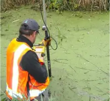
Founded in 2005, Isthmus Surveying has established itself as a trusted provider of professional land surveying services in Madison, Wisconsin, and surrounding areas. Our team combines 21 years of industry experience with state-of-the-art Trimble GPS and conventional surveying equipment to deliver precise boundary determinations for residential and commercial properties. We specialize in complex ALTA/ACSM surveys, subdivision plats, and topographic mapping while maintaining active memberships in the Wisconsin Society of Land Surveyors and American Congress on Surveying and Mapping.Our commitment to technical excellence is matched by our dedication to community involvement through annual charitable contributions and educational initiatives. As licensed and insured professionals, we prioritize clear communication and transparent pricing, ensuring clients receive accurate documentation within quoted timelines. Our expertise extends to GIS mapping development and GPS section corner control surveys across multiple Wisconsin counties, reflecting our deep regional knowledge and technical capabilities.

Services
Subdivision Platting
Boundary Surveys
ALTA/ACSM Surveys
Topographic Surveys
Site Planning
Details
- Year established: 2005
Highlights and features
- 21 years of professional land surveying experience
- Advanced Trimble GPS and conventional surveying equipment
- Transparent pricing with no hidden fees
- Active community involvement and charitable contributions
- Specialized expertise in ALTA/ACSM boundary surveys
Associations and certifications
- Wisconsin Society of Land Surveyors
- American Congress on Surveying and Mapping
What people say
Very professional
Timely manner
Fair price
Great turnaround time
Positive land surveying experience
Services
Subdivision Platting
We create detailed subdivision plats and certified survey maps for property development projects. Our licensed surveyors prepare condominium plats and parcel divisions that meet municipal requirements. This service ensures legal compliance for land divisions through precise boundary calculations and documentation.
Boundary Surveys
Our residential and commercial boundary surveys establish accurate property lines using GPS and conventional equipment. We provide legal documentation for real estate transactions and disputes. This service includes monumentation of corners and preparation of surveyor's reports for title insurance purposes.
ALTA/ACSM Surveys
We conduct comprehensive ALTA/ACSM boundary surveys meeting national standards for commercial properties. Our surveys include easement verification and encroachment analysis. This service provides lenders and title companies with detailed property information for real estate transactions.
Topographic Surveys
Our topographic surveys map natural and man-made features with elevation data. We use GPS technology to create detailed site plans for engineering projects. This service supports land development and environmental assessments through accurate terrain modeling.
Site Planning
We provide surveying support for site planning and land development projects. Our team creates lot line locations and foundation surveys for construction projects. This service integrates with engineering plans to ensure proper property utilization and regulatory compliance.
People
Paul A. Spetz
Owner and Founder
Licensed land surveyor with 21 years of experience specializing in boundary surveys and GPS mapping. Developed GIS maps for Wisconsin counties and conducted seminars at the Wisconsin State Land Surveying Institute. Maintains active involvement in local charitable initiatives.
Questions
What types of surveys do you specialize in?
We specialize in boundary surveys, subdivision plats, ALTA/ACSM surveys, topographic mapping, and site planning for residential and commercial properties.
How long does a typical survey take?
Most residential surveys take 1-2 weeks, while complex commercial projects may require additional time depending on property size and conditions.
Are your surveyors licensed and insured?
Yes, we are licensed by the State of Wisconsin with RLS #2525 and maintain full professional insurance coverage.
Do you use modern surveying technology?
We utilize Trimble GPS systems with centimeter-level accuracy alongside conventional total stations for optimal measurement precision.
What areas do you serve?
Primarily Madison and Dane County, with services extending to surrounding Wisconsin communities including Door and Kewaunee counties.
How are survey costs determined?
Costs depend on property size, terrain complexity, and required documentation. We provide detailed quotes before starting any project.