
Business Details
28 Years
experience
Expert Land Surveying Services in Austin, TX
Chaparral Professional Land Surveying has been a trusted provider of comprehensive land surveying services in Central Texas since 1998. Our family-owned and operated business combines over 25 years of industry experience with cutting-edge technology, including LiDAR and drone mapping, to deliver precise and efficient solutions for residential, commercial, and governmental clients. We specialize in boundary surveys, topographic mapping, construction staking, and hydrographic surveys, ensuring compliance with local and state regulations. Our team of licensed professionals is committed to maintaining the highest standards of accuracy and reliability, supported by memberships in the Texas Society of Professional Surveyors and the Texas Board of Professional Engineers and Land Surveyors.We prioritize prompt responses and free estimates, making it easy for clients to access our expertise. With a focus on innovation and customer satisfaction, we have completed thousands of projects across Austin and surrounding areas, including major developments like Crystal Falls and Concordia University. Our dedication to community extends to supporting local nonprofits through pro bono services and financial contributions. Founded on principles of integrity and excellence, we continue to invest in emerging technologies to meet evolving industry demands. Whether you require detailed boundary analysis or large-scale subdivision platting, our team is equipped to handle projects of all sizes with professionalism and precision.

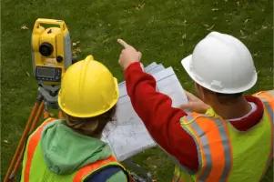
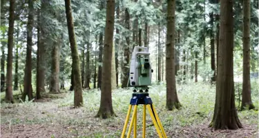
Services
Drone Surveying
Boundary Surveys
Tree Surveys
Topographic Surveys
Hydrographic Surveys
Construction Staking
Subdivision Platting
Aerial Control
GPS Surveys
Details
- Year established: 1998
Highlights and features
- We have over 25 years of experience in Central Texas land surveying.
- Our team includes licensed professionals with expertise in advanced technologies.
- We offer fast responses and free estimates for all projects.
- Our services comply with Texas Board of Professional Engineers and Land Surveyors standards.
- We specialize in complex projects like subdivision platting and hydrographic surveys.
What people say
Exceptional services
Fast responses
High-quality services
Trusted and licensed
Satisfied customers
Services
Boundary Surveys
Boundary surveys determine property lines and legal descriptions for real estate transactions, development, or dispute resolution. Our licensed surveyors use GPS and traditional methods to ensure compliance with Texas regulations. Clients receive detailed maps and documentation for easements, title insurance, or construction planning.
Drone Surveying
Drone surveying captures high-resolution aerial data for topographic mapping, construction monitoring, and land analysis. Our LiDAR-equipped drones provide precise 3D models and orthomosaic maps. This technology reduces field time and costs while improving data accuracy for large-scale projects like subdivisions and infrastructure development.
Topographic Surveys
Topographic surveys map natural and man-made features, including elevation changes, vegetation, and utilities. We use robotic total stations and GPS to create detailed site plans for engineering, architectural design, or environmental assessments. Results support drainage analysis, grading plans, and regulatory permitting in Central Texas.
Construction Staking
Construction staking translates design plans into physical markers for accurate building placement. Our team uses robotic total stations to set stakes for foundations, utilities, and roadways. This service ensures compliance with approved blueprints and local codes, minimizing costly rework during residential, commercial, or infrastructure projects.
Subdivision Platting
Subdivision platting divides large parcels into smaller lots for residential or commercial use. We prepare legal maps showing lot dimensions, easements, and access roads, ensuring compliance with municipal requirements. Our services include boundary analysis, utility design, and coordination with local planning commissions for final plat approval.
People
Paul J. Flugel
Senior Project Manager
Paul J. Flugel is a Registered Professional Land Surveyor with expertise in public and private sector projects. He specializes in right-of-way layouts, ALTA surveys, and GPS mapping. Paul has over 20 years of experience managing complex boundary and topographic surveys for Central Texas developments.
Kevin Pata
President and CFO
Kevin Pata, a certified public accountant with 35 years of experience, oversees financial operations at Chaparral. He holds a degree from Oklahoma State University and serves on the National Society of Professional Surveyors. Kevin ensures fiscal responsibility while supporting strategic growth initiatives.
Questions
What services does Chaparral Professional Land Surveying offer?
We provide boundary surveys, drone mapping, topographic surveys, construction staking, hydrographic surveys, and subdivision platting for residential, commercial, and governmental clients in Central Texas.
Do you offer free estimates?
Yes, we provide free estimates for all projects. Contact us at (512) 443-1724 to discuss your surveying needs and receive a customized quote.
How long has Chaparral been in business?
Chaparral Professional Land Surveying has served Central Texas since 1998, offering over 25 years of experience in land surveying and mapping services.
What areas do you serve?
We primarily serve Austin, TX, and surrounding Central Texas areas, including Pflugerville, Cedar Park, and Leander for residential and commercial surveying projects.
Are your surveyors licensed?
Yes, our team includes licensed professionals certified by the Texas Board of Professional Engineers and Land Surveyors, ensuring compliance with state standards and regulations.