Business Details
50+ Years
experience
Trusted Land Surveying Services in Lockhart, TX
Hinkle Surveyors has been a trusted provider of land surveying services in Central Texas since 1951. Founded as a family business, we combine decades of hands-on experience with cutting-edge technology to deliver precise and reliable results. Our team specializes in boundary surveys, title surveys, elevation certificates, and topographical mapping, serving Caldwell County and surrounding regions. With over 75 years of combined expertise, we utilize state-of-the-art GPS and robotic instruments to meet the evolving needs of our clients. Our commitment to personalized service ensures tailored solutions for residential, commercial, and industrial projects.As a registered professional land surveying firm, we uphold the highest standards of accuracy and integrity. Our legacy of excellence, built over generations, reflects our dedication to advancing the craft while maintaining the values instilled by our founders. Whether for property development, legal documentation, or infrastructure planning, we provide the technical precision and local knowledge essential for successful outcomes.
Services
Boundary Surveys
Title Surveys
Elevation Certificates
Topographical Surveys
Oil Well Locations
Details
- Year established: 1951
Highlights and features
- Family-owned since 1951 with 75+ years of combined surveying experience.
- Utilize state-of-the-art GPS and robotic instruments for accuracy.
- Specialize in boundary, title, and elevation surveys for all property types.
- Serve Caldwell County and 5+ surrounding Central Texas counties.
- Provide personalized service tailored to residential, commercial, and industrial needs.
Associations and certifications
- R.P.L.S. #5459
Services
Boundary Surveys
We conduct precise boundary surveys to define property lines using advanced GPS technology. Our surveys ensure legal compliance and resolve disputes for residential and commercial properties. With decades of experience, we deliver accurate measurements and detailed documentation for land development and ownership verification.
Title Surveys
Our title surveys identify property boundaries and encumbrances to support real estate transactions. We examine historical records and physical markers to confirm ownership rights. This service ensures clarity for buyers, sellers, and lenders in Caldwell County and surrounding areas.
Elevation Certificates
We provide elevation certificates for floodplain management and insurance requirements. Our surveys determine base flood elevations and building compliance with FEMA regulations. This service is critical for property owners in flood-prone areas of Central Texas.
Topographical Surveys
Our topographical surveys map natural and man-made features for construction and planning. Using robotic instruments, we create detailed elevation models to support site development. This service aids engineers and architects in designing infrastructure projects.
Oil Well Locations
We specialize in locating oil wells with precision for energy companies. Our surveys ensure compliance with regulatory standards and land agreements. This service supports exploration and production activities across Central Texas counties.
People
Jerry L. Hinkle
Registered Professional Land Surveyor
Jerry L. Hinkle, R.P.L.S. #5459, has practiced surveying since 1987. He learned the trade from his father, Claude, and became registered in 2000. Jerry leads Hinkle Surveyors with a commitment to precision and family legacy.
Questions
What services does Hinkle Surveyors offer?
We provide boundary surveys, title surveys, elevation certificates, topographical surveys, and oil well location services in Caldwell County and Central Texas.
How long has Hinkle Surveyors been in business?
Our family-owned business has served Central Texas since 1951, with over 75 years of combined surveying experience.
What areas do you serve?
We operate in Caldwell County and surrounding Central Texas counties including Bastrop, Hays, Gonzales, and Guadalupe.
What technology do you use for surveys?
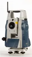
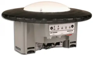
We use state-of-the-art GPS systems and SOKKIA robotic total stations to ensure precise and efficient land measurements.