
Business Details
Professional Land Surveying Services in Gainesville, TX
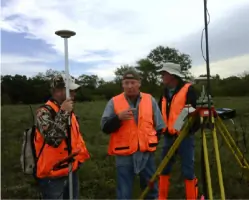
All American Surveying has been serving North Texas since 1978, evolving from Thompson Surveying into a premier land surveying firm. Our team combines traditional surveying methods with cutting-edge technology to deliver precise and reliable results for residential, commercial, and municipal projects. With over 20,000 surveys completed across multiple counties, we have built a reputation for excellence through decades of experience and technical expertise. Our professionals hold advanced certifications in CAD, GPS, and FEMA control systems, ensuring compliance with the highest industry standards. We prioritize client satisfaction by delivering projects on time while maintaining transparent communication throughout the process.Our leadership team brings over 75 combined years of experience in land surveying, engineering, and boundary resolution. We specialize in ALTA surveys, topographical mapping, flood elevation certifications, and construction layout services tailored to meet diverse client needs. Our commitment to innovation is demonstrated through UAV surveying technology that enhances data accuracy and efficiency. We serve property owners, title companies, architects, and developers with customized solutions that address complex land development challenges. Backed by decades of proven performance, we continue to expand our capabilities while maintaining the core values that have defined our success.
Services
Title Surveys
Boundary Surveys
Topographical Surveys
ALTA Surveys
Flood Certificates
Construction Layout
Estate Divisions
UAV Mapping
Annexation Maps
Platting Services
Highlights and features
- We have over 75 combined years of experience in land surveying and engineering industries
- We utilize cutting-edge technology for detailed and accurate surveying
- Our team includes licensed surveyors with specialized training in FEMA standards
- We guarantee timely delivery of all surveying projects
- We offer UAV surveying and mapping capabilities for enhanced efficiency
What people say
Professional, reliable, efficient
Great attention to detail
Excellent results
Reasonably priced
Exceptional firm
Services
Title Surveys
Title surveys precisely map property boundaries, improvements, and easements to support real estate transactions and mortgage approvals. Our surveys meet all legal requirements while identifying potential encumbrances. This service ensures property owners receive accurate documentation for title insurance purposes.
Boundary Surveys
Boundary surveys establish legal property lines for construction permits, fence installation, or dispute resolution. We use advanced GPS technology to verify historical records against physical markers. This service provides official documentation for land development projects.
Topographical Surveys
Topographical surveys create detailed elevation models showing natural and man-made features. Our UAV technology captures precise terrain data for engineering and construction planning. This service supports drainage analysis and site development projects.
ALTA Surveys
ALTA surveys meet national standards for commercial property transactions. We include boundary details, easements, and improvements in compliance with title insurance requirements. This service provides comprehensive documentation for lenders and property investors.
Flood Certificates
Flood elevation certificates determine property risk zones for FEMA compliance. We document elevation data to support flood insurance requirements and LOMA applications. This service helps property owners reduce insurance costs through accurate risk assessment.
People
John E. (J.T.) Thompson II
Owner/Founder
Licensed surveyor with 20+ years experience. Started as rodman in 1978, became registered surveyor in 1990. Specializes in construction surveying, boundary resolution, and UAV mapping technology.
Questions
What types of surveying services do you offer?
We provide title surveys, boundary surveys, topographical mapping, ALTA surveys, flood certificates, construction layout, and UAV mapping services for residential and commercial clients.
How can I request a survey?
Contact us through our website or phone number to discuss your project requirements. We'll schedule a site visit and provide a detailed scope of work for your approval.
What areas do you serve?
We serve all North Texas regions including Gainesville, Decatur, and surrounding counties with both field operations and office support services.
How long does a typical survey take?
Most residential surveys are completed within 3-5 business days. Commercial projects vary based on complexity but we guarantee timely delivery as specified in project agreements.
Are your surveyors licensed professionals?
Yes, our team includes licensed surveyors with specialized training in boundary resolution, FEMA standards, and advanced GPS technology applications.