Business Details
Trusted Land Surveying and Utility Engineering Services in Texas
RODS has been a trusted partner in Texas for over 30 years, dedicated to providing unwavering support to clients through meticulous attention to detail, solution-oriented thinking, and fostering strong relationships. Our team of highly skilled professionals utilizes state-of-the-art software and equipment to deliver the highest-quality land surveying and utility engineering services. With four strategically located offices across Texas, we mobilize quickly to serve clients, combining decades of experience with cutting-edge technology to meet project demands.Our Survey Group, established in 1994, and Utility Group, founded in 2007, have built a reputation for precision, innovation, and safety, serving municipalities, TxDOT, and private clients. As a certified woman/minority-owned HUB/DBE firm, we bring a proven track record of excellence to every project, ensuring successful outcomes through proactive communication and stakeholder collaboration.


Services
Land Surveying
Utility Engineering
Aerial Mapping
Subsurface Utility Investigations
Construction Layout
Right-of-Way Mapping
Topographic Surveying
Utility Coordination
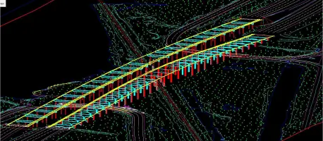
3D Digital Terrain Modeling
Flood Hazard Mapping
Highlights and features
- Certified by Texas state agencies and TxDOT for specialized services.
- Quality services with rapid deployment across four Texas offices.
- Comprehensive utility engineering and coordination expertise.
- Proven track record with municipalities and TxDOT projects.
- Team includes 8 Registered Professional Land Surveyors and 3 Professional Engineers.
Associations and certifications
- Texas Building & Procurement Commission
- Texas Unified Certification Program
- South Central Texas Regional Certification Agency
- Port of Houston Authority
Services
Land Surveying
RODS provides precise land surveying services, including boundary surveys, topographic mapping, and right-of-way design. Our team uses advanced tools like HD laser scanning and AutoCAD Civil3D to ensure accuracy for infrastructure and development projects. With decades of experience, we deliver reliable data for legal, engineering, and construction needs.
Utility Engineering
Our utility engineering services include subsurface utility investigations, coordination, and construction management. We adhere to ASCE standards and SUE quality levels to minimize risks and optimize project outcomes. Proactive communication with stakeholders ensures efficient utility relocation and compliance with regulatory requirements for roadway and infrastructure projects.
Aerial Mapping
RODS utilizes UAV drones and LiDAR technology for high-resolution aerial mapping. This enables efficient data collection for large-scale projects, supporting design and planning with detailed 2D and 3D models. Our methods reduce field time while maintaining precision for transportation, flood hazard, and land development applications.
Construction Layout
We provide construction layout surveys to guide infrastructure projects with exacting standards. Our services ensure alignment with design plans using advanced equipment for control points and elevation verification. This supports timely execution of roadway, drainage, and utility installation projects across Texas.
3D Digital Terrain Modeling
RODS creates 3D digital terrain models using LiDAR and photogrammetry data. These models support engineering design and analysis for complex projects, offering visual and analytical tools to optimize grading, drainage, and utility placement. Our deliverables enhance decision-making for transportation and land development initiatives.
People
Hilda S. Obregon Lease
President
Hilda leads RODS with a focus on strategic growth and client relations. Her engineering expertise and leadership ensure the firm maintains its reputation for excellence in surveying and utility engineering.
Jim Walton
Vice President
Jim oversees survey operations, leveraging his 10-45 years of experience as a Registered Professional Land Surveyor to ensure precision and adherence to industry standards across all projects.
Lane Lease
Vice President
Lane manages utility engineering initiatives, bringing extensive knowledge of subsurface utility investigations and coordination to optimize project outcomes for transportation and infrastructure clients.
Roberto Obregon
Senior Advisor
Roberto provides technical guidance and mentorship, drawing on decades of experience as a Registered Professional Land Surveyor to support RODS' commitment to innovation and quality.
Questions
What services does RODS offer?
RODS provides land surveying, utility engineering, aerial mapping, construction layout, and 3D terrain modeling services for infrastructure and development projects across Texas.
Is RODS certified for TxDOT projects?
Yes, RODS is TxDOT pre-certified in multiple categories, including surveying, utility engineering, and construction management, ensuring compliance with state transportation standards.
What technology does RODS use?
We use HD laser scanning, UAV drones, OpenRoads Designer, and AutoCAD Civil3D to deliver precise data and 3D models for efficient project execution.
How long has RODS been in business?
RODS has served Texas clients for over 30 years, with specialized surveying and utility engineering groups established in 1994 and 2007, respectively.
Are RODS' services available statewide?
Yes, with four offices in Spring, Edinburg, Laredo, and San Antonio, we provide rapid deployment and localized expertise across Texas.
What industries does RODS work with?
We support government agencies, engineers, architects, land developers, and public utilities with tailored surveying and engineering solutions for transportation and infrastructure projects.