
Business Details
39 Years
experience
Your Trusted Partner for Land Surveying Solutions
Jeffrey Moon & Associates is a full-service land survey company with a legacy of excellence since 1987. Our team combines decades of experience with cutting-edge technology to deliver precise, reliable results for residential, commercial, and public sector clients. Founded on the principles of integrity and quality, we trace our roots to the 1960s through the evolution of Arrowhead Surveying. Our three field crews and ten full-time staff, including three Registered Professional Land Surveyors, ensure comprehensive service across Montgomery County and surrounding areas. We specialize in subdivision design, drone surveys, topographic mapping, and floodplain analysis, utilizing UAV technology to enhance efficiency and accuracy.Committed to community engagement, we actively participate in local organizations and industry associations. Our transparent project management includes detailed scope definitions, timelines, and periodic updates for larger projects. Client satisfaction remains our priority, supported by a 30-year track record of successful project completions. We maintain membership in the Texas Society of Professional Land Surveyors and the Greater Conroe/Lake Conroe Area Chamber of Commerce. Our approach balances technological innovation with Wally Tuttle's timeless advice: prioritize quality work and ethical practices over profit.

Services
Subdivision Design
Commercial Development
Public Works Surveys
Drone Surveys
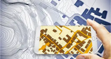
Topographic Mapping
Flood Plain Analysis
Elevation Certificates
Construction Layouts
Boundary Determination
Route Surveys
Details
- Year established: 1987
Highlights and features
- We offer 30+ years of continuous land surveying expertise since 1987
- Our team includes three Registered Professional Land Surveyors with local expertise
- We utilize UAV technology for enhanced survey accuracy and efficiency
- We provide comprehensive service from initial consultation to final deliverables
- Our community involvement demonstrates long-term regional commitment
Associations and certifications
- Texas Board of Professional Land Surveyors
Services
Subdivision Design
We create subdivision plats that maximize property value while meeting regulatory requirements. Our process combines document research with physical land surveys to establish lot divisions, easements, and flood zones. Clients receive compliant, optimized land development plans for residential or commercial projects.
Drone Surveys
Our UAV-assisted surveys provide rapid, accurate topographic data for large properties. This technology enables efficient floodplain mapping, volume calculations, and 3D modeling while reducing field time. Clients benefit from detailed ortho-rectified photos and elevation data for complex projects.
Elevation Certificates
We prepare FEMA-compliant elevation certificates by analyzing property data and Base Flood Elevations. Our documentation supports insurance requirements, LOMA applications, and building compliance. Clients receive accurate flood zone determinations with complete FEMA form submissions.
Construction Layouts
Our layout services ensure construction projects follow approved plans precisely. We mark reference points for subdivisions, utilities, and commercial buildings using advanced equipment. Clients receive verified field measurements to maintain compliance throughout the building process.
Topographic Surveys
We create detailed terrain maps showing natural and manmade features for land planning purposes. Our surveys support drainage analysis, landscape design, and architectural planning. Clients receive accurate elevation data for informed development decisions.
People
Jeffrey Moon
Vice President/Owner
Registered Professional Land Surveyor with 30+ years experience. Active daily operations leader. Maintains commitment to quality service and technological advancement while upholding founding principles of integrity.
Jake Lester
COO
Surveyor in Training and Certified Survey Technician managing daily operations. Coordinates field crews and client communications while ensuring adherence to professional standards and project timelines.
Aaron Collins
CAD Manager
Surveyor in Training and Certified Survey Technician responsible for digital mapping and technical documentation. Translates field data into precise CAD drawings for client deliverables and regulatory submissions.
Questions
What types of survey services do you offer?
We provide subdivision design, drone surveys, elevation certificates, construction layouts, and topographic mapping for residential, commercial, and public sector clients.
Do you serve areas outside Montgomery County?
While based in Montgomery County, we serve clients throughout Texas with specialized services for both urban and rural properties.
How does drone technology benefit surveying projects?
UAV technology enables faster data collection for large areas, improves safety access to difficult terrain, and provides detailed aerial mapping with precise elevation measurements.
What information is needed for a property survey estimate?
Please provide property address, legal description, survey type required, approximate size, and intended use to receive an accurate quotation.
Are your surveyors licensed professionals?
Yes, we employ three Registered Professional Land Surveyors and three Certified Survey Technicians maintaining state licensing requirements.