Business Details
37 Years
experience
Professional Land Surveying Services in Washington
Established in 1989, CSI Surveying has built a reputation as a trusted provider of professional land surveying services across Washington State and South Dakota. Our team of licensed surveyors combines decades of experience with advanced technology to deliver accurate, legally defensible boundary determinations, topographic mapping, and specialized surveys for residential, commercial, and governmental clients. We maintain comprehensive insurance coverage and adhere to strict professional standards, ensuring client confidence in every project. Our expertise extends to boundary line adjustments, FEMA elevation certificates, land subdivisions, and complex construction layout services.With offices in Gig Harbor and a service area spanning the Puget Sound region, we provide tailored solutions for property owners, consultants, and government agencies. Our commitment to precision is demonstrated through the use of cutting-edge tools like 3D laser scanning and GPS technology. As Certified Federal Surveyors, we uniquely serve tribal nations and members in Washington State. We prioritize transparent communication, offering preliminary cost estimates and detailed proposals to align with client budgets while maintaining compliance with state and local regulations.
Services
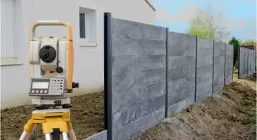
Boundary Surveying
Topographic Mapping
Land Subdivision
FEMA Elevation Certificate
Construction Layout
Details
- Year established: 1989
Highlights and features
- Licensed in Washington State and South Dakota with 35+ combined years of experience
- Certified Federal Surveyors authorized for tribal land services
- Utilize 3D laser scanning and GPS technology for accuracy
- Maintain comprehensive professional liability insurance
- Provide transparent cost estimates and fixed-fee contracts
Services
Boundary Surveying
We define property boundaries using high-tech equipment and deed research to ensure legal defensibility. Our surveys incorporate road alignments, easements, and historical records to resolve ownership disputes. Clients receive detailed maps that meet state and local regulatory requirements.
Topographic Mapping
Our topographic surveys create detailed 2D maps from 3D data showing terrain contours and physical features. This service helps clients minimize construction costs and optimize land use through accurate site analysis.
FEMA Elevation Certificate
We provide FEMA-required elevation certificates for flood insurance and building permits. Our licensed surveyors use GPS benchmarks to measure structures and determine flood risk compliance for waterfront properties.
Land Subdivision
We facilitate legal land divisions through short plats, long plats, and binding site plans. Our services include jurisdictional coordination and compliance with zoning regulations for creating new parcels.
Construction Layout
Our team provides precise construction layout services using RTK-GPS and robotic total stations. We ensure accurate building placement and infrastructure development while maintaining efficiency on active job sites.
People
David S Proctor
Principal/Manager
PLS and CFedS-certified surveyor with 21 years of experience managing Port Orchard operations. Specializes in tribal land surveys and federal projects requiring Bureau of Land Management compliance.
Gary A Proctor
Principal/Manager
Retired Marine Corps Lt Colonel with 21 years of surveying experience. Oversees Gig Harbor operations and provides expertise in complex boundary determinations and legal documentation.
Questions
What services do you offer?
We provide boundary surveys, topographic mapping, land subdivisions, FEMA elevation certificates, and construction layout services for residential and commercial clients.
Do you handle tribal land surveys?
Yes, as Certified Federal Surveyors, we're authorized to perform surveys for tribal nations and members in Washington State under Bureau of Land Management standards.
Are you licensed in Washington State?
Yes, we're fully licensed in Washington State and South Dakota with over 30 years of professional surveying experience.
How do you determine survey costs?
Costs depend on project complexity and scope. We provide ballpark estimates after initial consultation and formal proposals once requirements are defined.
Do you offer emergency services?
We don't provide emergency services but prioritize timely completion of all scheduled surveying projects with fixed-fee contracts.