
Business Details
Emergency
services
Your Trusted Geospatial Data Partner for Accurate Surveying & Mapping Solutions
At SAM, we deliver fast, accurate geospatial data to empower clients with actionable insights for infrastructure and development projects. With advanced technologies and expert teams, we specialize in mapping, surveying, GIS consulting, and inspection services for utilities, transportation, government, and natural resource sectors. Our national reach combines rapid deployment capabilities with local expertise, ensuring precise data collection and analysis tailored to complex program needs. Founded on a commitment to innovation and client success, we transform raw spatial data into strategic assets that drive informed decision-making.Our culture prioritizes collaboration, technological advancement, and employee engagement, reflected in recognitions like Charlotte Magazine's Top Workplace and ENR's Top 500 Design Firms ranking. Through services like subsurface utility engineering and 3D laser scanning, we minimize risks while maximizing efficiency across project lifecycles. With 13 consecutive years of industry recognition, we maintain rigorous quality standards through accreditations like Texas Firm Registration No. 10064300, ensuring compliance and reliability in every deliverable.
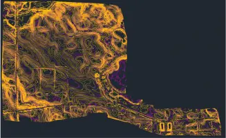

Services
Land Surveying
Aerial Mapping
GIS Consulting
Subsurface Utility Engineering
3D Laser Scanning
Powerline Inspection
Digital Twins
Construction Monitoring
Highlights and features
- We deploy geospatial teams within 24 hours for urgent data collection needs
- Our experts utilize cutting-edge LiDAR and 3D scanning technologies
- 13 consecutive years recognized in ENR's Top 500 Design Firms
- Specialized in complex infrastructure projects across utilities and transportation sectors
- Maintain rigorous data quality standards through Texas state accreditation
Associations and certifications
- Texas Firm Registration No. 10064300
Services
Land Surveying
Our land surveying services utilize high-precision GPS and total stations to establish accurate property boundaries and topographic data. We support infrastructure projects with ALTA/ACSM standards compliance and digital deliverables. Our Texas-licensed surveyors ensure regulatory adherence for real estate development and construction planning.
Aerial Mapping
Using UAV technology with LiDAR and photogrammetry, we create detailed 3D maps for large-scale projects. Our FAA-certified pilots capture data up to 80% faster than traditional methods while maintaining sub-centimeter accuracy for transportation and utility applications.
GIS Consulting
We develop enterprise GIS solutions that integrate infrastructure data with operational systems. Our consultants create interactive dashboards for asset management, enabling clients to visualize spatial relationships and optimize maintenance planning across utility networks.
Subsurface Utility Engineering
Our SUE services combine electromagnetic detection and ground-penetrating radar to locate buried utilities. We provide ASCE 38-02 quality level assessments that reduce excavation risks and prevent costly utility strikes during construction projects.
3D Laser Scanning
We capture millions of data points per second using terrestrial and mobile scanners to create precise BIM-ready models. This technology documents existing conditions for industrial facilities and infrastructure projects with millimeter-level accuracy.
Questions
What geospatial services does SAM specialize in?
We offer land surveying, aerial mapping, GIS consulting, 3D laser scanning, subsurface utility engineering, and powerline inspection services using advanced LiDAR technology.
How quickly can SAM deploy survey teams?
Our teams can mobilize within 24 hours to begin data collection for urgent infrastructure projects nationwide.
Which industries does SAM serve?
We support utilities, transportation, government agencies, and natural resource companies with geospatial data solutions.
What technology does SAM use for data collection?
We employ cutting-edge LiDAR systems, 3D scanning, and GIS platforms to ensure precise spatial data capture.
Is SAM accredited for surveying services?
Yes, we maintain Texas Firm Registration No. 10064300 and follow strict quality control standards.
How does SAM handle complex infrastructure projects?
Our experts provide comprehensive data solutions from initial mapping through construction monitoring for large-scale developments.