
Business Details
Expert Land Surveying Services in Salem, Oregon
Land Markers Surveying is a full-service land surveying firm based in Salem, Oregon, with over two decades of experience serving residential and commercial clients across the state. Our licensed professionals specialize in boundary surveys, topographic mapping, construction staking, and ALTA surveys, leveraging deep local market knowledge to anticipate and resolve potential issues. We maintain vital connections with local planning divisions and stay current with evolving laws and technologies to ensure precision. Our team prioritizes reliability, punctuality, and exceptional customer service, offering free estimates and rapid turnaround times. With a focus on Salem, Polk, Marion, Clackamas, Yamhill, and Linn counties, we deliver accurate surveys to prevent legal disputes.Our staff's 20-year track record demonstrates expertise in resolving complex boundary challenges and providing trusted solutions. We utilize advanced tools to meet engineering and design requirements while maintaining transparent communication throughout every project. Clients consistently praise our professionalism, competitive pricing, and ability to meet urgent deadlines, making us a preferred choice for realtors, contractors, and property owners. Our commitment to quality is reflected in detailed documentation, including FEMA elevation certificates and subdivision plats, ensuring compliance with regulatory standards. By combining technical proficiency with personalized service, we aim to exceed client expectations on every project.

Services
Topographic Survey
Boundary Survey
ALTA Survey
Construction Staking
Property Line Adjustments
FEMA Elevation Certificates
Partition/Subdivision Plats
Locate Property Corner
Highlights and features
- We have over 20 years of experience in Oregon land surveying.
- Our team maintains deep connections with local planning divisions.
- We use advanced technology to ensure precise measurements and compliance.
- We offer free estimates and rapid turnaround times for urgent needs.
- Clients consistently praise our reliability, punctuality, and professionalism.
What people say
Very friendly staff
Done right and done quickly
Best surveyors in Salem
Fantastic turnaround time
Great pricing
Services
Topographic Survey
This survey maps property elevations and existing improvements for engineering and design purposes. Our team uses advanced tools to create detailed terrain models that guide construction and development projects. Accurate topographic data ensures proper planning and regulatory compliance for residential and commercial clients.
Boundary Survey
We establish property boundaries using deed records, previous surveys, and physical evidence. Our licensed surveyors locate or set property corners and prepare official maps for county records. This service resolves disputes and clarifies land ownership for real estate transactions and development projects.
ALTA Survey
This commercial survey provides title companies with required property information for insurance purposes. We follow strict ALTA/NSPS standards to identify easements, encroachments, and other factors affecting property ownership and development potential.
Construction Staking
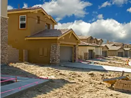
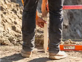
We set physical stakes based on engineering plans to guide construction projects. Our precise horizontal and vertical alignments ensure accurate placement of buildings, roads, and utilities. This service helps contractors maintain compliance with design specifications and zoning regulations.
FEMA Elevation Certificates
We prepare elevation certificates to determine flood insurance rates using FEMA data. Our surveyors identify flood zones and measure structure elevations relative to base flood levels. This documentation helps property owners secure accurate insurance coverage and comply with federal requirements.
Questions
What types of land surveys do you offer?
We provide boundary surveys, topographic mapping, ALTA surveys, construction staking, property line adjustments, FEMA elevation certificates, and subdivision plats for residential and commercial properties.
Do you serve areas outside Salem?
While based in Salem, we serve the entire state of Oregon with primary focus areas including Polk, Marion, Clackamas, Yamhill, and Linn counties.
How quickly can you complete a survey?
Our typical turnaround time varies by project complexity, but we prioritize urgent requests and have accommodated last-minute real estate closings successfully.
Are your surveyors licensed professionals?
Yes, all our surveyors are licensed professionals with over 20 years of combined experience in Oregon land surveying practices and regulations.
Do you offer free estimates?
Yes, we provide free estimates for all our land surveying services. Contact us via phone or our website to request a no-obligation quote.
How do you handle property disputes?
We use deed records, previous surveys, and physical evidence to resolve boundary issues. Our detailed documentation helps prevent legal disputes through accurate property delineation.