Business Details
50+ Years
experience
Trusted Geotechnical Engineering Services in Berkeley
Alan Kropp & Assoc is a well-respected geotechnical consulting firm specializing in seismic hazards and geohazard mitigation. Founded in 1975, we operate as a privately-owned business with a strong ethical commitment to our profession, community, and environment. Our team of experts provides comprehensive services including geo-investigations, hazard assessments, construction monitoring, and expert litigation support. We serve a diverse clientele across public and private sectors, including government agencies, educational institutions, and commercial developers. Our work spans complex projects such as landslide risk analysis, seismic upgrades for historic structures, and innovative flood control solutions.With decades of experience, we combine technical expertise with practical problem-solving to deliver tailored solutions for challenging geotechnical conditions. Our subsidiary, Pacific Aerial Surveys, offers historical aerial imagery dating back to 1928, enhancing site analysis capabilities. Recognized for excellence, we received the American Public Works Association's Project of the Year Award for environmental innovation. Our team actively contributes to professional and community initiatives, maintaining leadership in geotechnical engineering standards. We prioritize client collaboration, ensuring transparent communication and adherence to the highest industry benchmarks.
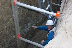
Services
Geo-Investigations
Geo-Hazard Assessments
Construction Monitoring
Expert Litigation Support
Aerial Imagery Services
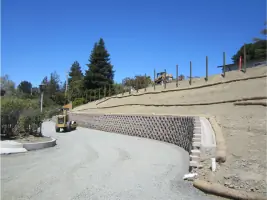
Landslide Repair
Liquefaction Mitigation
Seismic Hazard Studies
Foundation Design
Forensic Evaluations
Details
- Year established: 1975
Highlights and features
- We have over 50 years of experience in geotechnical engineering and seismic hazard analysis.
- Our team specializes in complex geo-hazard assessments and mitigation strategies.
- We offer comprehensive services from site investigations to construction oversight.
- Our subsidiary provides unique historical aerial imagery dating back to 1928.
- We maintain active leadership roles in professional geotechnical organizations.
Services
Geo-Investigations
Our geo-investigations provide comprehensive subsurface analysis through borings, cone penetration tests, and geophysical surveys. We deliver tailored geotechnical frameworks for project design, including settlement predictions and foundation recommendations. Our services support infrastructure development, building construction, and environmental projects requiring precise soil and rock characterization.
Geo-Hazard Assessments
Specialized hazard assessments identify and mitigate risks from landslides, liquefaction, and seismic activity. We conduct probabilistic seismic hazard analyses and slope stability calculations to develop mitigation strategies. Our work ensures compliance with California DSA and CGS standards for schools, hospitals, and critical infrastructure.
Construction Monitoring
We provide continuous geotechnical observation during construction to verify compliance with design specifications. Our services include material testing, foundation installation monitoring, and subsurface condition verification. This ensures structural integrity for projects ranging from high-rise buildings to transportation infrastructure.
Expert Litigation Support
Our experts offer forensic analysis and testimony for geotechnical disputes, including insurance claims and construction litigation. We provide causation evaluations, aerial photo interpretation, and neutral third-party investigations. Our team has supported major insurance companies and court-appointed mediation processes.
Aerial Imagery Services
Pacific Aerial Surveys, our subsidiary, maintains California's largest historical aerial imagery archive dating to 1928. We provide digital mapping, custom flights, and LiDAR analysis to support land development, environmental studies, and forensic investigations with precise spatial data.
People
Alan Kropp
Principal Engineer and President
With over 50 years of experience, Alan Kropp leads seismic hazard assessments and geotechnical investigations. Recognized for 50 years of service by California's engineering board, he specializes in landslide analysis and historic preservation projects.
David Ruiz
Aerial Imagery Specialist
David Ruiz applies historical aerial imagery analysis to resolve property disputes and infrastructure challenges. His expertise in photogrammetry supported a San Francisco driveway access solution, demonstrating practical applications of geospatial data.
Questions
What geotechnical services do you specialize in?
We specialize in geo-investigations, hazard assessments, construction monitoring, expert litigation support, and aerial imagery analysis for seismic, landslide, and liquefaction risks.
Do you work with residential property owners?
Yes, we provide foundation design, landslide repair recommendations, and seismic upgrades for residential properties in geologically complex areas.
Can you assist with insurance-related geotechnical claims?
Our team conducts forensic evaluations for insurance companies regarding landsliding, settlement, and construction vibration claims from major insurers.
Do you handle public infrastructure projects?
Yes, we've worked on transportation systems, flood control channels, and school seismic upgrades, including award-winning environmental projects like the New Ohlone Creek naturalization.
What makes your aerial imagery services unique?
We maintain California's largest historical aerial imagery archive dating to 1928, providing critical data for land use analysis and forensic investigations.
Are your services available outside the Bay Area?
While based in Berkeley, we serve projects throughout California, including Concord, Novato, and Newark, with nationwide consulting capabilities.