Business Details
10 Years
experience
Advanced Laser Radar Systems for Commercial and Military Applications
Burns Technologies was founded in August 2016 by four principals of H.N. Burns Engineering Corporation following the retirement of its owner/president. Our company continues to deliver the same exceptional products and services developed over 33 years of innovation in laser radar technology. Specializing in commercial and military Lidar systems, we provide cutting-edge solutions for corridor mapping, autonomous flight, and terrain awareness. Our Multi-Function Laser Radar (MFL) system sets industry standards for helicopter safety in degraded visual environments. We tailor our core technology to meet specific customer needs, ensuring precision and reliability in every application.With decades of combined experience, our team brings deep expertise in engineering and aerospace technologies. Our systems integrate advanced sensors, real-time data processing, and intuitive displays to enhance operational safety. We maintain rigorous quality standards through continuous testing and validation with leading institutions like Johns Hopkins APL. Our commitment to innovation drives ongoing development of next-generation laser radar capabilities. Backed by a legacy of engineering excellence, we remain dedicated to solving complex challenges for commercial and defense clients worldwide.
Services
Lidar Surveying
Military Lidar Systems
Autonomous Flight Support
Terrain Awareness
Sensor Development
Details
- Year established: 2016
Highlights and features
- We offer 33 years of engineering expertise in laser radar technology
- Our systems are validated by institutions like Johns Hopkins APL
- We provide tailored solutions for commercial and military applications
- Our MFL system operates in zero-visibility conditions
- We maintain rigorous quality standards through continuous testing
Services
Commercial Lidar Surveying
Our commercial Lidar surveying system provides high-precision corridor mapping capabilities. Using eye-safe laser technology, it generates real-time 3D terrain models with sub-centimeter accuracy. The system integrates digital elevation data and color-coded hazard identification for enhanced situational awareness.
Military Lidar Systems
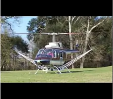
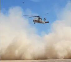
Military-grade Lidar systems support rotorcraft operations in degraded visual environments. Our technology enables safe landing zone determination and obstacle field navigation through real-time 3D imaging. Systems include collision hazard detection with visual and audible alerts for flight crews.
Autonomous Flight Support
Advanced sensor packages enable autonomous flight operations for military aircraft. Our systems provide terrain awareness, obstacle avoidance, and precision landing capabilities. Technology includes multi-hit detection and georeferenced data fusion for enhanced navigation accuracy.
Sensor Development
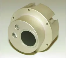
We develop specialized sensors like the EBAIR eyesafe infrared system and HOB height-of-burst sensors. Our solutions feature high-resolution data capture, environmental adaptability, and integration with existing avionics systems for both commercial and defense applications.
Terrain Awareness
Helicopter terrain awareness systems provide real-time visualization of flight paths and hazards. Our HTAWS capabilities include collision detection with tiered alert systems, operating effectively in all weather conditions and low-visibility environments.
Questions
What commercial applications do your Lidar systems support?
Our commercial Lidar systems specialize in corridor mapping and terrain surveying for infrastructure projects, environmental monitoring, and geographic data collection.
How do your military systems improve flight safety?
Military Lidar systems provide real-time 3D imaging for landing zone assessment, obstacle detection, and terrain awareness in zero-visibility conditions during day or night operations.
Can your technology integrate with existing aircraft systems?
Yes, our systems interface with inertial navigation systems and avionics bays, providing fused data displays compatible with modern cockpit instrumentation requirements.
What autonomous flight capabilities do you offer?
Our technology enables autonomous rotorcraft operations including obstacle field navigation, safe landing zone determination, and collision avoidance systems for unmanned aerial vehicles.
How is your Lidar technology different from traditional systems?
Our eye-safe Lidar systems offer sub-centimeter range accuracy, multihit detection capabilities, and real-time data visualization with color-coded hazard identification not found in conventional systems.