Business Details
33 Years
experience
Subsurface Utility Engineering Experts
At SUE Solutions, we have dedicated ourselves to delivering timely, accurate, and cost-effective utility services since 1993. Our team brings extensive experience in subsurface utility engineering and GIS mapping, serving both public and private sectors nationwide. We specialize in providing customized solutions that address complex underground utility challenges while prioritizing client satisfaction. With over 30 years of industry expertise, we leverage cutting-edge technologies like ground-penetrating radar and 3D utility design to ensure precise data collection and analysis. Our nationwide reach enables us to support diverse infrastructure projects, from highway improvements to private utility systems. We maintain rigorous quality control standards, with accuracy tolerances within +/- 0.01 foot, to minimize project risks and redesign costs.Our full in-house capabilities allow for complete turn-key project delivery, from initial test hole excavation to final digital data production. We emphasize transparent communication throughout the process, including direct coordination with utility owners during test hole operations. Our comprehensive service offerings include utility locating, system mapping, risk analysis, and asset management solutions tailored to specific project requirements. Through systematic reviews by qualified independent reviewers, we ensure data competency and accuracy across all deliverables while maintaining compliance with DOT CADD and industry standards.
Services
QL-A Test Hole Service
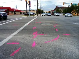
QL-B Utility Designating
Ground Penetrating Radar
Utility Coordination
3D Utility Design
GIS Mapping
Details
- Year established: 1993
Highlights and features
- We have over 30 years of experience in subsurface utility engineering.
- Our nationwide reach ensures service availability across the United States.
- We maintain +/- 0.01 foot accuracy tolerances for all test hole data.
- Our full in-house capabilities enable complete turn-key project delivery.
- We systematically review all data through qualified independent reviewers.
Services
QL-A Test Hole Service
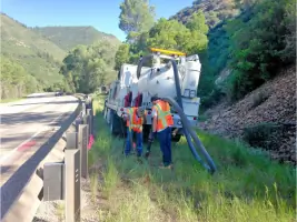
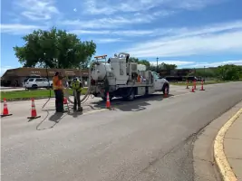
Our QL-A test hole service determines precise horizontal and vertical utility positions using vacuum excavation methods. We expose underground facilities through asphalt cores or native soil excavation, then measure depths with GPS surveying where possible. This service allows project engineers to eliminate design conflicts by verifying exact utility locations before construction, minimizing redesign risks through +/- 0.01 foot accuracy standards.
Ground Penetrating Radar
We employ ground-penetrating radar technology to identify non-conductive utilities in challenging soil conditions. Our technicians use 10 MHz to 1 GHz frequency ranges optimized for different soil strata, supplementing with electromagnetic detection in clay soils. This creates accurate geospatial output for 3D modeling and real-time conflict resolution, particularly effective where traditional locating methods face material limitations in utility detection.
Utility Coordination
Our coordination services manage utility-related aspects throughout project phases. We handle initial investigations, utility as-built acquisition, and stakeholder negotiations with railroads, municipalities, and agencies. We conduct plan reviews, process relocation agreements, and provide post-design follow-up while maintaining ongoing communication with affected utility owners to streamline complex projects.
GIS Mapping
We integrate GPS, GIS, and traditional surveying data into comprehensive mapping systems for infrastructure projects. Our team converts subsurface utility data into user-friendly 3D models that aid design teams in analyzing routing options and planning ahead. This includes maintaining DOT CADD standards compliance and providing Microstation-compatible deliverables through our Micro Utility Viewer application.
3D Utility Design
We offer utility system design services for water, wastewater, gas, and communication facilities. Our engineers perform safety analyses, risk assessments, and asset evaluations while maintaining current mapping systems. We support both advisory roles for project engineers and complete design execution, focusing on meeting both present infrastructure needs and future growth requirements.
Questions
What is QL-A Test Hole Service?
It's a utility verification method using vacuum excavation to expose underground facilities and measure their exact locations and depths.
How does your GPR locating work?
We use ground-penetrating radar frequencies adjusted for specific soil conditions to detect non-metallic utilities where traditional methods fail.
What areas do you serve?
We provide nationwide service across the United States for both public infrastructure and private utility projects.
What accuracy standards do you maintain?
Our test hole data meets +/- 0.01 foot tolerances while utility designating complies with ASCE 38-02 1-foot accuracy standards.
How do you handle utility coordination?
We manage complete coordination processes including utility negotiations, plan reviews, and documentation from initial investigation through project completion.
What mapping technologies do you use?
We integrate GPS, GIS, and traditional surveying methods to create comprehensive 3D utility mapping systems for infrastructure projects.