
Business Details
49 Years
experience
Professional Land Surveying Services in Milford, OH
Lansdale Surveying has served the Greater Cincinnati and Northern Kentucky areas since 1977, delivering precise land surveying solutions under the leadership of owner Jay Olberding, who acquired the company in 1995. Our team combines decades of experience with advanced technology to execute boundary surveys, construction staking, ALTA/ACSM surveys, and topographic mapping with meticulous attention to legal compliance. Licensed in Ohio and Kentucky, we maintain active memberships in the National Society of Professional Surveyors and state associations, ensuring adherence to evolving industry standards.Our commitment to efficiency, accuracy, and affordability has solidified our reputation as a trusted partner for residential and commercial development projects. We prioritize client satisfaction through transparent communication, competitive pricing, and a dedication to completing projects within budget and timeline constraints.

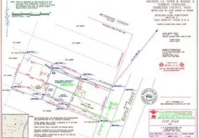
Services
Boundary Surveys
Lot Splits
ALTA/ACSM Surveys
Topographic Surveys
Construction Staking
Flood Elevation Certificates
Site Plans
Legal Descriptions
Plot Plans
Details
- Year established: 1977
Highlights and features
- Licensed in Ohio and Kentucky for comprehensive regional coverage
- Efficient project execution using high-tech surveying tools
- Accurate results aligned with current planning laws
- Affordable pricing with skilled, experienced professionals
- Active memberships in professional surveying organizations
What people say
Highest quality
Free to place new boundary markers
Price came in far below estimation
Highly recommend them
Return customer
Services
Boundary Surveys
We conduct comprehensive boundary surveys to define property lines with precision. Our team uses advanced tools to ensure legal compliance and resolve disputes. Clients receive detailed documentation for real estate transactions or development projects.
ALTA/ACSM Surveys
Our ALTA/ACSM surveys meet national standards for commercial property transactions. We identify easements, encroachments, and legal restrictions. Clients gain critical insights for title insurance and development planning.
Topographic Surveys
We create detailed topographic maps showing natural and man-made features. Data supports site planning, drainage analysis, and construction design. Clients receive accurate elevation models for engineering purposes.
Construction Staking
Our staking services guide infrastructure projects with exact positioning. We mark utilities, foundations, and grading points. Clients benefit from reduced errors and adherence to project specifications.
Flood Elevation Certificates
We provide FEMA-compliant elevation certificates for floodplain management. Data helps determine insurance requirements and mitigation strategies. Clients receive certified documentation for regulatory compliance.
People
Jay Olberding
President
Jay Olberding, President of Lansdale Surveying, has over 25 years of leadership experience since acquiring the company in 1995. He ensures adherence to industry standards and client-focused service delivery.
Mark Harding
Vice President
Mark Harding, Vice President, oversees daily operations and client relations at Lansdale Surveying. With extensive project management expertise, he maintains the company's commitment to accuracy and efficiency.
Jeff Houchin
Surveyor
Jeff Houchin, a licensed surveyor, contributes technical expertise to fieldwork and data analysis. His attention to detail ensures precise results for boundary, topographic, and construction-related projects.
Questions
What areas do you serve?
We primarily serve Greater Cincinnati and Northern Kentucky but can travel to other locations as needed.
Are you licensed in Ohio and Kentucky?
Yes, we hold active licenses in both states to provide comprehensive surveying services.
What types of surveys do you offer?
We specialize in boundary surveys, ALTA/ACSM surveys, topographic mapping, construction staking, and flood elevation certificates.
How do you ensure survey accuracy?
We use advanced technology and stay updated on legal requirements to deliver precise, compliant results.
Can you handle both residential and commercial projects?
Yes, we serve both residential property owners and commercial developers with tailored solutions.
What are your office hours?
Our office is open Monday through Friday from 8:00 AM to 5:00 PM.