Business Details
19 Years
experience
Expert Land Surveying Services in Corona, CA
Since 2007, CL Survey has redefined the standards of land surveying through innovation and precision. Headquartered in Southern California, we are a certified small, disadvantaged, and minority-owned business driven by licensed Professional Land Surveyors committed to excellence. Our expertise spans geodetic, topographic, cadastral, construction, LiDAR, and rail surveying, serving both public agencies and private clients. With 18 years of experience, 9 licensed surveyors, and 16 survey crews, we combine technical expertise with cutting-edge technology to deliver cost-effective, customized solutions.We specialize in navigating complex projects across highways, rail, airports, and urban infrastructure while maintaining a relentless focus on accuracy and client satisfaction. Our certifications in California, Utah, Oregon, and Washington underscore our commitment to diversity and quality. From initial design to final construction, we lay the foundation for the future, transforming challenges into opportunities with integrity and innovation.
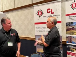
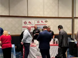
Services
Geodetic Surveying
Topographic Surveying
Cadastral Surveying
Construction Surveying
LiDAR Scanning
Rail Surveying
Details
- Year established: 2007
Highlights and features
- We have 18 years of specialized experience in land surveying since 2007.
- Our team includes 9 licensed Professional Land Surveyors and 16 survey crews.
- We utilize advanced LiDAR scanning and geospatial technologies for accuracy.
- Certified as a disadvantaged, minority-owned business in California, Utah, Oregon, and Washington.
- We maintain a 98% client retention rate through tailored project solutions.
Services
Geodetic Surveying
Establishing precise geodetic control networks to serve as foundational frameworks for large-scale infrastructure projects. Our surveys ensure millimeter-level accuracy for transportation corridors, utility systems, and urban developments. Utilizing GPS and advanced instrumentation, we provide reliable spatial references that maintain integrity across project phases.
Topographic Surveying
Creating detailed topographic maps that capture terrain features and surface characteristics for engineering and planning purposes. Our surveys support drainage analysis, site development, and environmental assessments. High-resolution data collection enables informed decision-making for land use and construction projects.
Cadastral Surveying
Conducting legal boundary surveys to establish property lines and resolve land ownership disputes. We adhere to strict cadastral standards for subdivision plats and title transfers. Our work provides legally defensible documentation for real estate transactions and land development projects.
Construction Surveying
Providing precise construction layout services to translate engineering designs into physical site implementations. Our team ensures accurate placement of infrastructure elements within 0.01 foot tolerances. Real-time monitoring maintains alignment throughout building and grading operations.
LiDAR Scanning
Capturing high-density 3D point cloud data using terrestrial, mobile, and UAV LiDAR systems. Our scanning services support as-built documentation and structural analysis. Rapid data acquisition reduces field time by 60% compared to traditional methods while maintaining sub-centimeter resolution.
People
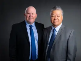
Lam Le
President
Licensed Professional Land Surveyor with 25+ years of experience leading complex infrastructure projects. Specializes in transportation and utility surveying across California. Holds multiple state certifications and maintains active involvement in industry associations.
Daniel Calvillo
Executive Vice President
20-year veteran in geospatial technologies with expertise in LiDAR and GIS applications. Oversees technical operations and innovation initiatives. Instrumental in expanding the firm's capabilities in unmanned aerial surveying systems.
Robert Vasquez
Vice President
Licensed surveyor specializing in boundary resolution and cadastral surveys. Manages client relations and business development across Southern California. Holds degrees in civil engineering and land surveying from Cal Poly Pomona.
Marcus Reedy
Regional Director
Pacific Northwest operations lead with extensive experience in rail and highway corridor surveys. Coordinates multi-state project teams and ensures compliance with regional surveying standards across Oregon and Washington.
Jon Broadwater
Project Manager
Senior project manager overseeing transportation infrastructure surveys. Specializes in coordinating large-scale projects with simultaneous field operations. Maintains professional certifications in both California and Arizona.
Questions
What surveying services does CL Survey offer?
We provide geodetic, topographic, cadastral, construction, LiDAR scanning, and rail surveying services for public and private infrastructure projects.
Are your surveyors licensed professionals?
Yes, all our surveyors are licensed Professional Land Surveyors (PLS) with state-specific certifications across California, Oregon, and Washington.
Do you work on transportation projects?
Yes, we specialize in rail, highway, and airport surveying with extensive experience on major transit corridors like the MidCoast Transit Expansion.
What technology do you use?
We employ GPS systems, robotic total stations, and LiDAR scanners (terrestrial, mobile, and UAV) for high-accuracy data collection and 3D modeling.
Are you a certified minority-owned business?
Yes, we hold certifications as a Disadvantaged Business Enterprise (DBE) and Minority Business Enterprise (MBE) in multiple western states.
What geographic areas do you serve?
Our primary service areas include California, Oregon, and Washington with regional offices supporting local project requirements.