Business Details
39 Years
experience
Your Trusted Surveying Partner in Tustin, CA
At the Culver Group, we have dedicated ourselves to revolutionizing the surveying industry through innovation, speed, and precision since 1987. Our team leverages cutting-edge technology to deliver the most accurate results possible, ensuring efficiency and reliability for every project. From fieldwork to final deliverables, we partner with clients to provide tailored solutions that meet their unique needs. Our expertise spans conventional surveying, 3D laser scanning, mapping, and laser metrology, serving both public agencies and private clients across California. We prioritize client collaboration, combining modern technology with timeless principles to ensure safety, accuracy, and budget adherence.Our experienced professionals produce detailed, design-ready digital files that empower informed decision-making. With offices in Tustin, Corona, and Northern California, we offer localized expertise while maintaining national standards of excellence. Our commitment to quality is reflected in our comprehensive process, which minimizes errors and delays through advanced scanning and modeling techniques. Recognized for our dedication and professionalism, we have built a reputation as a trusted partner in the construction and development sectors. By focusing on transparency, technical excellence, and client-centric service, we continue to help projects succeed from layout to as-built documentation.
Services
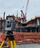
Conventional Survey
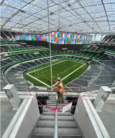
3D Laser Scanning
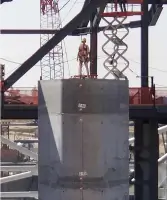
Mapping & Modeling
Laser Metrology
Scan to BIM
Details
- Year established: 1987
Highlights and features
- We have over 35 years of experience in professional surveying services.
- Our team utilizes advanced 3D laser scanning and BIM modeling technology.
- We deliver tailored solutions for construction projects from layout to completion.
- Our process minimizes errors and delays through accurate data collection.
- We maintain offices in Tustin, Corona, and Northern California for regional expertise.
Services
Conventional Survey
Our conventional surveying services provide essential data for construction management decisions. Using proven methodologies, we ensure accurate boundary determination, topographic mapping, and site analysis. This foundational work supports infrastructure development, land division, and regulatory compliance across California's diverse landscapes.
3D Laser Scanning
Advanced 3D laser scanning creates precise digital models for as-built documentation. This technology captures detailed spatial data, enabling efficient design validation and construction monitoring. Our services support complex projects requiring millimeter-level accuracy in aerospace, aviation, and large-scale infrastructure.
Mapping & Modeling
We produce detailed topographic maps and BIM models rich in data. These tools enable accurate project visualization, volume calculations, and site analysis. Our deliverables integrate seamlessly with design software, supporting informed decision-making throughout the construction lifecycle.
Laser Metrology
Our laser metrology services achieve sub-millimeter accuracy (+/-0.0006 inches) for critical applications. This technology supports aerospace and aviation industries through precise component alignment, dimensional analysis, and quality control processes.
Scan to BIM
Scan-to-BIM services convert as-built data into actionable digital models. By integrating 3D scans with topographic surfaces, we create comprehensive building information models that optimize construction workflows and facility management systems.
Questions
What surveying services do you offer?
We provide conventional surveying, 3D laser scanning, mapping, laser metrology, and Scan-to-BIM services for construction and infrastructure projects.
How long have you been in business?
The Culver Group has provided professional surveying services since 1987, with over 35 years of industry experience.
What technology do you use?
We utilize advanced 3D laser scanning, BIM modeling, and precision measurement tools to ensure millimeter-level accuracy for all projects.
Do you serve clients outside California?
While our primary focus is California, we have experience working on regional and national projects through strategic partnerships.
How do you ensure project accuracy?
Our combination of modern technology, experienced professionals, and rigorous quality control processes ensures precise data collection and deliverables.
Can you handle complex infrastructure projects?
Yes, our team specializes in complex projects requiring advanced scanning, modeling, and precision measurement for aerospace, aviation, and construction sectors.